
IMAGES TAKEN NEAR TO
Western Harbour View, EDINBURGH, EH6 6PF
Introduction
This page details the photographs taken nearby to Western Harbour View, EH6 6PF by members of the Geograph project.
The Geograph project started in 2005 with the aim of publishing, organising and preserving representative images for every square kilometre of Great Britain, Ireland and the Isle of Man.

There are currently over 7.5m images from over14,400 individuals and you can help contribute to the project by visiting https://www.geograph.org.uk
Image Map
Images are licensed for reuse under creativecommons.org/licenses/by-sa/2.0
Notes
- Clicking on the map will re-center to the selected point.
- The higher the marker number, the further away the image location is from the centre of the postcode.
Image Listing (93 Images Found)
Images are licensed for reuse under creativecommons.org/licenses/by-sa/2.0
Image
Details
Distance
1

Western Harbour redevelopment
Looking southwest - the area between 'The Element' and the disused lighthouse has now been smartened up, with some rustic exercise features.
Image: © M J Richardson
Taken: 8 Jul 2015
0.02 miles
2

Western Harbour View
One of the tallest buildings in the city, overlooking undeveloped plots which have become wetlands.
Image: © Richard Webb
Taken: 28 Jul 2016
0.03 miles
3

West Breakwater, Leith.
The development of the Leith shore on the West Breakwater. This is part of a massive redevelopment of the shoreline, an attempt to emulate the likes of Vancouver with a residential shoreline. Taken from the east breakwater.
Image: © Richard Webb
Taken: 25 Aug 2005
0.04 miles
4

Western Harbour
The new residential development at Western Harbour, Leith catches the Christmas Day sunlight in this long distance view from Cramond Island.
Image: © Alan Murray-Rust
Taken: 25 Dec 2009
0.04 miles
5

Western Harbour View
For now, but there are undeveloped plots between here and the harbour.
Image: © Richard Webb
Taken: 28 Jul 2016
0.04 miles
6

Western Harbour, Leith
Viewed from over the Firth of Forth, on approach to Edinburgh Airport. The apartment blocks in the foreground are part of the redevelopment of the old dock area. Top left is Ocean Terminal; the two large blocks on the right are Chancelot Mill, with the moored Troms oil industry vessels just to the left Image
Image: © M J Richardson
Taken: 14 Oct 2017
0.04 miles
7

Regeneration of the western harbour
This shows the work going on across the waters of the Port Of Leith. This is the area called Newhaven.
Image: © Carol Walker
Taken: 1 Sep 2007
0.04 miles
8
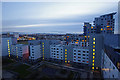
Modern apartment blocks, Leith Western Harbour
At dusk. These apartment blocks have been built on reclaimed land. The blocks are arranged in rectangles, each surrounding a quadrangle. There is underground car parking. So far, 3 rectangles have been completed, but there is space for more.
The Pentland Hills are in the distance.
Image: © Ian Taylor
Taken: 29 Dec 2013
0.05 miles
9

Western Harbour, Leith
The development of the west side of Leith Docks halted with the collapse of banks in 2008. There is a strange feeling of dereliction beyond the futuristic "white city".
Image: © Richard Webb
Taken: 28 Jul 2016
0.05 miles
10

Western Harbour Midway
Continuing the long-established Edinburgh tradition of giving a whole area of streets with the same core name and different endings, the streets here are all called Western Harbour 'Something'. In this case, 'Something' is Midway. The block on the right is part of The Element.
Image: © Anne Burgess
Taken: 12 May 2012
0.05 miles