
IMAGES TAKEN NEAR TO
Polbeth Farm Drive, EH55 8UZ
Introduction
This page details the photographs taken nearby to Polbeth Farm Drive, EH55 8UZ by members of the Geograph project.
The Geograph project started in 2005 with the aim of publishing, organising and preserving representative images for every square kilometre of Great Britain, Ireland and the Isle of Man.

There are currently over 7.5m images from over14,400 individuals and you can help contribute to the project by visiting https://www.geograph.org.uk
Image Map
Images are licensed for reuse under creativecommons.org/licenses/by-sa/2.0
Notes
- Clicking on the map will re-center to the selected point.
- The higher the marker number, the further away the image location is from the centre of the postcode.
Image Listing (18 Images Found)
Images are licensed for reuse under creativecommons.org/licenses/by-sa/2.0
Image
Details
Distance
1
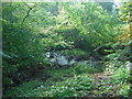
West Calder Burn
A fallen tree forms an arch over the burn
Image: © Jim Smillie
Taken: 12 Oct 2010
0.04 miles
2
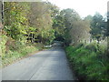
Road narrows
On bridge over West Calder Burn
Image: © Jim Smillie
Taken: 12 Oct 2010
0.05 miles
3
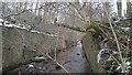
Walled section of West Calder Burn
It isn't that obvious why it was decided that there was the need to build these two massive retaining walls. They are definitely here because, just South of the road bridge - which has been present in some shape or form for at least 200 years - there used to be a railway line serving two or more shale mines crossing the burn where the walls now sit.
Old OS maps show that the railway didn't cross the water via an actual bridge however; the water disappears from the maps for a short but significant length, indicating that a culvert was built and earth piled on top to facilitate a wide crossing and to keep the track horizontal. Considering the amount of earth that must have had to be taken away to get to the culvert it seems odd that they didn't just take the final loads away from the banks to save building the wall. Or just leave the whole thing in place - a wide crossing over a culvert built for exactly the same reasons is still in place a few hundred yards upstream. The crossing was still in place in the 1960s (though it was then a track as opposed to a railway), so there are probably still people alive who did the work - I'll have to ask about...
Image: © Ian Dodds
Taken: 18 Dec 2022
0.05 miles
4
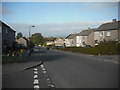
Polbeth Road
Houses probably dating from late 1950's early 1960's.
Image: © Jim Smillie
Taken: 12 Oct 2010
0.10 miles
5
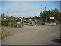
Five Sisters Zoo
The entrance is right beside that of the Allandale Fishery.
Image: © Jim Smillie
Taken: 12 Oct 2010
0.11 miles
7

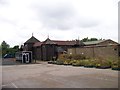
Polbeth from the air
Five Sisters Zoo is it the bottom of the photo.
Image: © Thomas Nugent
Taken: 4 Aug 2013
0.14 miles
8

Five Sisters Zoo from the air
At Polbeth, on the outskirts of Edinburgh. Viewed shortly after take-off towards the west from Edinburgh Airport.
Image: © Thomas Nugent
Taken: 14 May 2012
0.14 miles
9

Five Sisters Zoo from the air
In the centre of the photo, around the lake. A small zoo at Polbeth on the outskirts of Livingston http://www.fivesisterszoo.co.uk/ . West Calder is visible in the background.
Image: © Thomas Nugent
Taken: 14 May 2012
0.14 miles
10
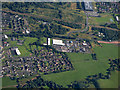
Polbeth from the air
Polbeth Industrial Estate in the centre, West Calder High School in the top right corner.
Image: © Thomas Nugent
Taken: 13 Aug 2019
0.15 miles