
IMAGES TAKEN NEAR TO
Chapelton Grove, WEST CALDER, EH55 8SW
Introduction
This page details the photographs taken nearby to Chapelton Grove, EH55 8SW by members of the Geograph project.
The Geograph project started in 2005 with the aim of publishing, organising and preserving representative images for every square kilometre of Great Britain, Ireland and the Isle of Man.

There are currently over 7.5m images from over14,400 individuals and you can help contribute to the project by visiting https://www.geograph.org.uk
Image Map
Images are licensed for reuse under creativecommons.org/licenses/by-sa/2.0
Notes
- Clicking on the map will re-center to the selected point.
- The higher the marker number, the further away the image location is from the centre of the postcode.
Image Listing (13 Images Found)
Images are licensed for reuse under creativecommons.org/licenses/by-sa/2.0
Image
Details
Distance
2
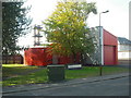
West Calder Fire Station
This station dates from 1978.
Image: © Jim Smillie
Taken: 12 Oct 2010
0.10 miles
3
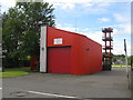
West Calder Fire Station
On Polbeth Road, Polbeth.
Image: © M J Richardson
Taken: 29 Jul 2015
0.10 miles
4
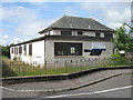
Welcome to Polbeth Clinic
An NHS Lothian facility, now for sale and boarded up.
Image: © M J Richardson
Taken: 29 Jul 2015
0.12 miles
5
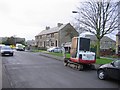
Polbeth
Largish village between West Calder and Livingston. Has uniform blocks of substantial housing. The gas board , or whatever daft name ending in a "a" they are currently using, are in town.
Image: © Richard Webb
Taken: 10 Dec 2005
0.12 miles
6
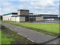
St Mary's RC Primary School
In Polbeth.
Image: © M J Richardson
Taken: 29 Jul 2015
0.14 miles
7
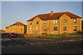
Polbeth Crescent
The setting sun gives a rosy glow to houses at the end of Polbeth Crescent.
Image: © Anne Burgess
Taken: 7 Jan 2018
0.16 miles
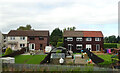
9
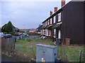
Polbeth
Largish village between West Calder and Livingston. There are uniform blocks of similar looking municipal housing. This area contains timber clad houses. Looking north.
Image: © Richard Webb
Taken: 10 Dec 2005
0.18 miles
10
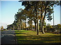
Green space
Grassy area with trees separating Calderburn Road from the A71.
Image: © Jim Smillie
Taken: 12 Oct 2010
0.18 miles