
IMAGES TAKEN NEAR TO
Chapelton Drive, WEST CALDER, EH55 8SQ
Introduction
This page details the photographs taken nearby to Chapelton Drive, EH55 8SQ by members of the Geograph project.
The Geograph project started in 2005 with the aim of publishing, organising and preserving representative images for every square kilometre of Great Britain, Ireland and the Isle of Man.

There are currently over 7.5m images from over14,400 individuals and you can help contribute to the project by visiting https://www.geograph.org.uk
Image Map
Images are licensed for reuse under creativecommons.org/licenses/by-sa/2.0
Notes
- Clicking on the map will re-center to the selected point.
- The higher the marker number, the further away the image location is from the centre of the postcode.
Image Listing (19 Images Found)
Images are licensed for reuse under creativecommons.org/licenses/by-sa/2.0
Image
Details
Distance
1
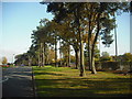
Green space
Grassy area with trees separating Calderburn Road from the A71.
Image: © Jim Smillie
Taken: 12 Oct 2010
0.10 miles
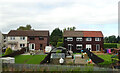
3
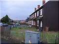
Polbeth
Largish village between West Calder and Livingston. There are uniform blocks of similar looking municipal housing. This area contains timber clad houses. Looking north.
Image: © Richard Webb
Taken: 10 Dec 2005
0.11 miles
4
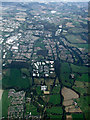
Livingston from the air
Polbeth is in the foreground, with Brucefiled Industrial Estate also prominent in the foreground.
Image: © Thomas Nugent
Taken: 22 Sep 2014
0.14 miles
6
Polbeth
Largish village between West Calder and Livingston. Has uniform blocks of substantial housing. The gas board , or whatever daft name ending in a "a" they are currently using, are in town.
Image: © Richard Webb
Taken: 10 Dec 2005
0.15 miles
7

Limefield Falls, Polbeth
This interesting waterfall is situated on Harwood Water, a tributary of the River Almond, at the far side of the large recreation park in Polbeth. The picture was taken from a viewing platform which was only completed a few months back, along with the fish pass that can be seen on the right of the shot.
A number of fish passes (also often called fishways or fish ladders) have been constructed in West Lothian over the last few years. They are put in to allow fish to travel upstream when they wouldn't otherwise be able to because of an obstruction, which is usually a weir, as is the case here. Although not always mentioned they do often assist fish travelling downstream too of course - I don't imagine many fish relish the prospect of dropping eight feet from the edge here! This fish pass has to double back on itself so as not to be impassably steep, but it still looks like quite a challenge to me. Like most things, these fish passes are quite technical affairs when you investigate them in more detail, and there is no doubt a lot going on that is hidden from view - the water flow down the way has to be managed carefully and resting pools are usually needed for the fish along the passes, for instance.
The falls, which were once a few feet higher, are man-made, and purely decorative (a lade was added later as a bit of an afterthought, to provide water for a walled garden). They were put in in 1880 by James 'Paraffin' Young as a tribute to the famous missionary and explorer David Livingstone. Young, the pioneer of West Lothian's historically important shale oil industry, lived at the nearby Limefield House and was a friend of Livingstone from the days before they had both made their mark -in fact it could be said that Young actually helped Livingstone make his mark, as he sponsored a number of his African trips.
Livingstone is reckoned to have been the first European to view the Victoria Falls, on the Zambezi River, between Zambia and Zimbabwe, and it was he who gave it its name - it obviously has a far more exotic real name in a local language, but for whatever reason Livingstone felt duty bound to honour his queen! Considering the Victoria Falls is 350 feet high there isn't much of a comparison really, but it's a nice spot and a good story!
Image: © Ian Dodds
Taken: 31 May 2021
0.15 miles
8
Limefield Road
Typical woodclad houses found in Polbeth.
Image: © Richard Webb
Taken: 21 Feb 2012
0.15 miles
9
West Calder Fire Station
This station dates from 1978.
Image: © Jim Smillie
Taken: 12 Oct 2010
0.16 miles
10
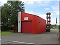
West Calder Fire Station
On Polbeth Road, Polbeth.
Image: © M J Richardson
Taken: 29 Jul 2015
0.16 miles