
IMAGES TAKEN NEAR TO
Westwood, WEST CALDER, EH55 8PN
Introduction
This page details the photographs taken nearby to EH55 8PN by members of the Geograph project.
The Geograph project started in 2005 with the aim of publishing, organising and preserving representative images for every square kilometre of Great Britain, Ireland and the Isle of Man.

There are currently over 7.5m images from over14,400 individuals and you can help contribute to the project by visiting https://www.geograph.org.uk
Image Map
Images are licensed for reuse under creativecommons.org/licenses/by-sa/2.0
Notes
- Clicking on the map will re-center to the selected point.
- The higher the marker number, the further away the image location is from the centre of the postcode.
Image Listing (10 Images Found)
Images are licensed for reuse under creativecommons.org/licenses/by-sa/2.0
Image
Details
Distance
1

Five Sisters Business Park
On the site of the shale oil works
Image: © Jim Smillie
Taken: 17 Apr 2021
0.10 miles
2

Short Tunnel under B7015
A railway line used to run here from the early 1940s to the early 1960s, transporting shale mined at Mid Breich Pits nos 1 and 2, a few hundred yards North of here, to Westwood Oil Works, a few hundred yards South. The short railway line ran under the road at this point according to contemporary OS maps. The tunnel is essentially just a bricked-up bridge, with a square hole cut into one of the bricked-up ends for no obvious reason. The bottles and odd bits of rubbish must have washed in through the hole during heavy rain; nobody would come here for fun, however desperate - the rain has also washed in a great deal of sludgy mud.
It is quite hard to make out in the picture - mobile phones still don't come close to proper cameras when using the flash - but there is a narrow opening after the lit-up section of wall on the right. This gives access to an identical tunnel, so presumably there were actually two tracks running between the pits and the oil works - the empties probably got sent back on a separate track. Both tunnels are around five and a half feet high and wide, and thirty-odd feet long - the other one is fully blocked off.
Image: © Ian Dodds
Taken: 18 Aug 2021
0.11 miles

4

Westwood Caravan Storage Park
And, beyond, Five Sisters Business Park.
Image: © M J Richardson
Taken: 25 Sep 2017
0.17 miles
6

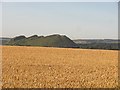
West Calder from the air
On approach to Edinburgh from the west.
Image: © Thomas Nugent
Taken: 30 May 2014
0.23 miles

8

Muck spreading
View over manured pasture to 'Five Sisters' shale bings.
Image: © Jim Smillie
Taken: 8 Apr 2009
0.24 miles

10
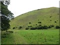
Five Sisters
The famous bing is now mapped by the Ordnance Survey with contours, just like a real hill.
Image: © Richard Webb
Taken: 1 Aug 2014
0.24 miles