
IMAGES TAKEN NEAR TO
WEST CALDER, EH55 8PJ
Introduction
This page details the photographs taken nearby to EH55 8PJ by members of the Geograph project.
The Geograph project started in 2005 with the aim of publishing, organising and preserving representative images for every square kilometre of Great Britain, Ireland and the Isle of Man.

There are currently over 7.5m images from over14,400 individuals and you can help contribute to the project by visiting https://www.geograph.org.uk
Image Map
Images are licensed for reuse under creativecommons.org/licenses/by-sa/2.0
Notes
- Clicking on the map will re-center to the selected point.
- The higher the marker number, the further away the image location is from the centre of the postcode.
Image Listing (11 Images Found)
Images are licensed for reuse under creativecommons.org/licenses/by-sa/2.0
Image
Details
Distance
1

Breich Water
View to woodland on north bank
Image: © Jim Smillie
Taken: 19 Aug 2021
0.08 miles
2
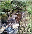
Large rocks: Breich Water
The bank on the right has been reinforced.
Image: © Jim Smillie
Taken: 19 Aug 2021
0.11 miles
3

Area of cleared forestry
Former triangular area of forestry beside Breich Water
Image: © Jim Smillie
Taken: 19 Aug 2021
0.13 miles
4

Auchenhard Tower in the Mist
Described as both a gothic picturesque folly and a hunting tower by online references. There is no reason of course it can't have been both. It is situated on the North bank of Breich Water, and belonged to, and quite possibly still does belong to Auchenhard House, which is just a bit further up the bank. The date of construction is unknown and is thought to be at some point between the late 1700s and the early 1800s. Interestingly, the house and grounds were bought by James 'Paraffin' Young, the local shale oil industry pioneer, who lived there while overseeing the construction of the massive Addiewell Chemical Works nearby, and remained in his ownership until his death, upon which they passed to his company. Remarkably the house, and neighbouring Auchenhard Farm, which he bought along with the house, weren't actually bought out from oil company ownership until the 1980s. The house itself was derelict since the 1960s, but was restored about 15 years ago. Christmas lights were twinkling in the house window today, so all still in good repair as the professionals would say.
Image: © Ian Dodds
Taken: 11 Dec 2020
0.15 miles
5

Closeup of Auchenhard Tower
There are three narrow arched windows on the bottom floor, not including the one at ground level that can be seen in the picture, and two similar windows on what was once the first floor. It looks like there were once also two more windows at the door-side of the tower, judging by the remains.
There is a small pile of stones nearby, but it doesn't appear that the condition of the tower is deteriorating quickly - an image on the Canmore website from 1990 looks identical to this one.
Image: © Ian Dodds
Taken: 11 Dec 2020
0.15 miles
6

Five Sisters bing from the air
Catching the late evening sunshine between the clouds on the approach to Edinburgh Airport from the west.
Image: © Thomas Nugent
Taken: 26 Apr 2013
0.18 miles
7

Sycamore tree
Hanging on to the edge of Addiewell Bing
Image: © Jim Smillie
Taken: 19 Aug 2021
0.19 miles
8
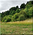
Wooded slope
This is the western end Addiewell Bing Nature Reserve.
Image: © Jim Smillie
Taken: 19 Aug 2021
0.19 miles
9

Remains of a mineral railway
An embankment of a long closed colliery railway.
Image: © Richard Webb
Taken: 1 Nov 2011
0.22 miles
10
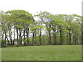
Beech shelterbelt at Cuthill Brae
With the valley of the Breich Water beyond.
Image: © M J Richardson
Taken: 14 May 2015
0.23 miles