
IMAGES TAKEN NEAR TO
WEST CALDER, EH55 8NR
Introduction
This page details the photographs taken nearby to EH55 8NR by members of the Geograph project.
The Geograph project started in 2005 with the aim of publishing, organising and preserving representative images for every square kilometre of Great Britain, Ireland and the Isle of Man.

There are currently over 7.5m images from over14,400 individuals and you can help contribute to the project by visiting https://www.geograph.org.uk
Image Map
Images are licensed for reuse under creativecommons.org/licenses/by-sa/2.0
Notes
- Clicking on the map will re-center to the selected point.
- The higher the marker number, the further away the image location is from the centre of the postcode.
Image Listing (6 Images Found)
Images are licensed for reuse under creativecommons.org/licenses/by-sa/2.0
Image
Details
Distance
1

Farmhouse: Rusha
Substantial stone building
Image: © Jim Smillie
Taken: 26 Jul 2021
0.05 miles
2
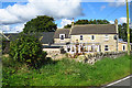
Rusha Farm
The farm is inside a bend in the road, from which this view was taken.
Image: © Anne Burgess
Taken: 19 Sep 2017
0.06 miles
3

Livestock sheds
With a very neat stone dyke running alongside the road
Image: © Jim Smillie
Taken: 26 Jul 2021
0.07 miles
4

Rusha
Some newer houses at the farm, with May green grass for the sheep. The familiar landmark of the Five Sisters in the background.
Image: © Richard Webb
Taken: 11 May 2006
0.08 miles
5
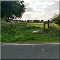
Sheep at the gate
In the shade of the trees at Rusha
Image: © Jim Smillie
Taken: 26 Jul 2021
0.08 miles
6
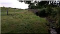
Old Bridge near Site of Rusha Quarry
The bridge allows passage across Longhill Burn, which further downstream turns into West Calder Burn, the village of West Calder being, in the main, built on its Southern side. Rusha Quarry, which old maps show was operational between at least the mid 1800s and early 1900s, was situated on the right hand side of the burn past the bridge.
It seems unlikely that the bridge was connected with the quarry, as there was a track leading to the quarry from the road which Rusha farm was (and still is) situated on. The only old map showing a continuation of the track over the bridge shows it as stopping just short of the former farm of Dykehead, which itself could be reached from another road, so it was probably built just to get produce and livestock across without faffing about with fords.
In the OS naming books, compiled during the surveying of their initial maps, the quarry is described as being "of considerable note". Some kind of firestone called 'lake-stone' (which doesn't appear in any dictionaries) was extracted here, and must have been of very high quality as small amounts were apparently shipped to America for use in ovens and fire safes.
The quarry gets its name from the farm of the same name. Having done a bit of digging it turns out that the name, disappointingly, has no connections to Russia itself. Pre-OS maps call it both Rushaw and Raeshaw. My hunch is that it is an eliding of 'Rush Shaw'. Lots of place-names just East of here have 'Rash' (a Scottish version of 'rush') at the start, and "shaw' is generally agreed to have denoted a wood, or something wood-related in Middle English, a common dialect of which was spoken in the Southern Scotland and Northern England in mediaeval times.
Image: © Ian Dodds
Taken: 27 Jul 2021
0.09 miles