
IMAGES TAKEN NEAR TO
Mooreland Gardens, WEST CALDER, EH55 8JD
Introduction
This page details the photographs taken nearby to Mooreland Gardens, EH55 8JD by members of the Geograph project.
The Geograph project started in 2005 with the aim of publishing, organising and preserving representative images for every square kilometre of Great Britain, Ireland and the Isle of Man.

There are currently over 7.5m images from over14,400 individuals and you can help contribute to the project by visiting https://www.geograph.org.uk
Image Map
Images are licensed for reuse under creativecommons.org/licenses/by-sa/2.0
Notes
- Clicking on the map will re-center to the selected point.
- The higher the marker number, the further away the image location is from the centre of the postcode.
Image Listing (33 Images Found)
Images are licensed for reuse under creativecommons.org/licenses/by-sa/2.0
Image
Details
Distance
1

Addiewell and Loganlea Memorial Garden
Sculpture in a beautifully kept park and play area.
Image: © Richard Webb
Taken: 11 Mar 2008
0.03 miles
2
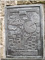
Addiewell and Loganlea Memorial Cairn detail
Image: © Richard Webb
Taken: 11 Mar 2008
0.03 miles
3
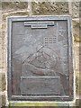
Addiewell and Loganlea Memorial Cairn detail
Commemorating those who fought both directly and indirectly, mining coal and oil in the two great wars of the Twentieth Century.
Those who had to remain home to work the mines ,farms and in other essential industries are often forgotten on war memorials.
A beautiful work, well worth visiting.
Image: © Richard Webb
Taken: 11 Mar 2008
0.03 miles
4
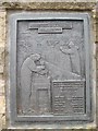
Addiewell and Loganlea Memorial Cairn detail
Image: © Richard Webb
Taken: 11 Mar 2008
0.04 miles
5
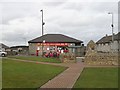
Addiewell post office
With the memorial cairn.
Image: © Richard Webb
Taken: 11 Mar 2008
0.04 miles
6
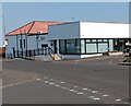
The Pit Stop
Former Miners Welfare, now a Community Hub including "The Village larder"
Image: © Jim Smillie
Taken: 25 Aug 2021
0.07 miles
7

Loganlea Memorial Cairn
This cairn which lies in the Addiewell and Loganlea Memorial Garden is dedicated to the people of the area who died in both World Wars and also to those who died in the Coal and Oil Shale industries upon which the villages developed.
Image: © Kevin Rae
Taken: 29 May 2006
0.10 miles
8

Recreation Park, Addiewell
Recreation Park is probably the most common name for a football ground in Britain, though this one (humourously referred to as San Siro on the sign to the far left of the goal) doesn't really qualify as a ground. The substitutes and managers are afforded some shelter by the small red-and-white dugouts, but that's about it for facilities here.
Loganlea United play here in the bottom tier of the Edinburgh and Lothians amateur leagues, though they will surely be moving up a level shortly, leaving the likes of Mental Mechanics behind, having won 15 out of 15 so far this season.
The pitch is hidden behind the houses on Mooreland Gardens - both Moorelands and Mooreland Gardens were named after Sarah 'Ma' Moore (Moorelands was named after her during her lifetime), a woman described as having a very forceful personality in her obituaries. She was a Labour councillor for Addiewell from the 1920s until her death in the 1940s. On top of this she seemed to work on every committee and board going, including some for prisons and hospitals, and was active in various campaigns, often concerning living standards. And on top of that she had nine children, and was a poet!
Image: © Ian Dodds
Taken: 9 Mar 2022
0.11 miles
9
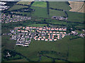
Loganlea from the air
Breich Water is in the foreground.
Image: © Thomas Nugent
Taken: 27 Jun 2014
0.13 miles
10
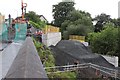
Skolie Burn Bridge (7)
Construction work to form the west abutment of the temporary diversion bridge.
Image: © Graeme Yuill
Taken: 5 Jul 2019
0.15 miles