
IMAGES TAKEN NEAR TO
Burngrange Court, WEST CALDER, EH55 8HA
Introduction
This page details the photographs taken nearby to Burngrange Court, EH55 8HA by members of the Geograph project.
The Geograph project started in 2005 with the aim of publishing, organising and preserving representative images for every square kilometre of Great Britain, Ireland and the Isle of Man.

There are currently over 7.5m images from over14,400 individuals and you can help contribute to the project by visiting https://www.geograph.org.uk
Image Map
Images are licensed for reuse under creativecommons.org/licenses/by-sa/2.0
Notes
- Clicking on the map will re-center to the selected point.
- The higher the marker number, the further away the image location is from the centre of the postcode.
Image Listing (29 Images Found)
Images are licensed for reuse under creativecommons.org/licenses/by-sa/2.0
Image
Details
Distance
1

Burngrange Court in snow
This is the cul-de-sac at the east end of Burngrange Court in West Calder. The large tree was cut down a few months later.
Image: © Claire M Jordan
Taken: Unknown
0.01 miles
2

Woods under snow at Burngrange Court
This is the lane section of Burngrange Court in West Calder, heading towards Burngrange Cottages, with just over half an acre of bat-haunted, wild-growing wood and heath on the right, in the midst of all the houses.
Image: © Claire M Jordan
Taken: Unknown
0.05 miles
3

Burngrange Cottages
Typical inter-war style of council houses common throughout central Scotland.
Image: © Jim Smillie
Taken: 15 Oct 2010
0.07 miles
4

14 West End, West Calder
This nice old stone house on the way into West Calder from the West also goes by the name of 'Fairfield'. It went up at some point between Ordnance Survey's first two maps of the area, surveyed in the 1850s and 1890s. In the 1890s there was a field behind the house. By the time of the third map, surveyed in 1905, the field behind formed part of a golf course which occupied a long narrow series of fields stretching from the church two doors down to the left, to far beyond where West Calder's Burngrange residential area finishes today. The cemetery, which still marks the edge of the village, was about halfway along the course.
There is, coincidentally, still a small unbuilt-on area at the back of this house in amongst the village suburbia, which runs alongside Burngrange Court. It is shown on maps by trees but is now something of a wasteland, so it might improve things if a couple of houses went up there. Or has it been recently been left in such a state to break down resistance to such an idea - i.e. it's all part of a cunning plan?
Image: © Ian Dodds
Taken: 5 Jun 2023
0.07 miles
5

West Kirk of Calder
Building dates from 1880.
Image: © Jim Smillie
Taken: 15 Oct 2010
0.08 miles
6

West Calder Medical Centre
West Calder has a large medical centre with its own integral pharmacy, and convenient access to St John's, the large district hospital in Livingston.
Image: © Anne Burgess
Taken: 20 Feb 2018
0.08 miles
7
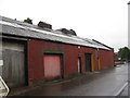
World War I drill hall at West Calder
Originally the rifle range but with a century or more of modification. http://www.geograph.org.uk/article/WW1-Great-War-Centenary---Drill-Halls/
Image: © M J Richardson
Taken: 21 Aug 2014
0.09 miles
8

Ex-drill hall, Young Street
In West Calder. I was told that this building was a 'rifle range'. http://www.geograph.org.uk/article/WW1-Great-War-Centenary---Drill-Halls/
Image: © M J Richardson
Taken: 21 Aug 2014
0.09 miles
9

Ex-drill hall at West Calder
On Young Street - I was told that the left hand building was a 'rifle range' and the brick building, now a partly boarded up house, but still lived in, was a 'Territorial Army' building. In its time the home of the 10th (Cyclist) Battalion, Royal Scots (G Company). http://www.geograph.org.uk/article/WW1-Great-War-Centenary---Drill-Halls
Image: © M J Richardson
Taken: 21 Aug 2014
0.09 miles
10

West Calder medical centre
Occupying a substantial part of Burngrange Park. Former home of West Calder United
Image
Image: © Jim Smillie
Taken: 15 Oct 2010
0.10 miles