
IMAGES TAKEN NEAR TO
Society Lane, WEST CALDER, EH55 8EL
Introduction
This page details the photographs taken nearby to Society Lane, EH55 8EL by members of the Geograph project.
The Geograph project started in 2005 with the aim of publishing, organising and preserving representative images for every square kilometre of Great Britain, Ireland and the Isle of Man.

There are currently over 7.5m images from over14,400 individuals and you can help contribute to the project by visiting https://www.geograph.org.uk
Image Map
Images are licensed for reuse under creativecommons.org/licenses/by-sa/2.0
Notes
- Clicking on the map will re-center to the selected point.
- The higher the marker number, the further away the image location is from the centre of the postcode.
Image Listing (51 Images Found)
Images are licensed for reuse under creativecommons.org/licenses/by-sa/2.0
Image
Details
Distance
1

R & J Macdonald
Kilt makers. Main Street, West Calder.
Image: © Richard Webb
Taken: 3 Sep 2010
0.03 miles
2

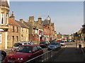
Looking west along West Calder Main Street
Nobody is ever going to exclaim over West Calder's picturesque beauty, but it's a serviceable village with an interesting roof line. The boarded-up shop front just beyond the silver car used to be a newsagent's, and is now a private house.
Image: © Claire M Jordan
Taken: 3 Oct 2009
0.03 miles


6

Buildings at the back of Scotmid, West Calder
West Calder has an interesting layout, with private houses and allotments coming right up to the back of the supermarket - it's not big enough to have any transitional zones.
Image: © Claire M Jordan
Taken: 3 Oct 2009
0.07 miles
7

Central plaza, West Calder
View across the central plaza from beside the town clock, looking towards Scotmid. Somewhere behind the shops is a householder who keeps free-ranging peacocks who can sometimes be seen stalking across the plaza, or even going into Scotmid and nicking bread rolls.
Image: © Claire M Jordan
Taken: 3 Oct 2009
0.07 miles
9

The Co-operative Clock
A memorial to the victims of the Burngrange Disaster in January 1947. 15 miners were killed in an explosion in the Burngrange oilshale mine. http://www.scottishmining.co.uk/32.html
* David Carroll, shale miner, married 36
* William Carroll, shale miner, married 31 (David & William were brothers)
* Henry Law Cowie, shale miner, single, 36
* George Easton, shale miner, married, 53
* John Fairley, shale miner, single, 20
* William Gray Boyd Findlay (formerly Shields), shale miner, married 56
* Anthony Gaughan, shale miner, married 45
* William Greenock, shale miner, married, 50
* Thomas Dempster Heggie, shale miner, married 26
* John Sommerville Lightbody, shale miner, married 41
* James McAuley, shale miner, married 59
* John McGarty, shale miner, single, 30
* David Muir, shale miner, single, 25
* Samuel Dargavel Pake, shale miner, married 24
* William Findlay Ritchie, shale miner, married 38
Image: © Richard Webb
Taken: 3 Sep 2010
0.08 miles
10

Co-Op Buildings
This large Victorian building was one of two built across the road from one another. The architect was William Baillie (1875-1951), who also designed Image The one on this side of the road has been demolished and replaced by an open space.
Image: © Anne Burgess
Taken: 19 Sep 2017
0.09 miles