
IMAGES TAKEN NEAR TO
Mungle Place, WEST CALDER, EH55 8BZ
Introduction
This page details the photographs taken nearby to Mungle Place, EH55 8BZ by members of the Geograph project.
The Geograph project started in 2005 with the aim of publishing, organising and preserving representative images for every square kilometre of Great Britain, Ireland and the Isle of Man.

There are currently over 7.5m images from over14,400 individuals and you can help contribute to the project by visiting https://www.geograph.org.uk
Image Map
Images are licensed for reuse under creativecommons.org/licenses/by-sa/2.0
Notes
- Clicking on the map will re-center to the selected point.
- The higher the marker number, the further away the image location is from the centre of the postcode.
Image Listing (53 Images Found)
Images are licensed for reuse under creativecommons.org/licenses/by-sa/2.0
Image
Details
Distance
1

Masonic Lodge
The modest panel above the brash shop fronts reveals that this building is (or possibly was) a masonic lodge.
Image: © Anne Burgess
Taken: 19 Sep 2017
0.02 miles

3

Co-Op Buildings
This large Victorian building was one of two built across the road from one another. The architect was William Baillie (1875-1951), who also designed Image The one on this side of the road has been demolished and replaced by an open space.
Image: © Anne Burgess
Taken: 19 Sep 2017
0.02 miles
4

Mungle Street, West Calder
This is one of those great little jumbled-up streets that are often to be found just off the main roads of old towns, though whether West Calder can still lay claim to being a town is debatable. It certainly was a town a generation or two ago, and though it probably actually now has more houses than it did back then, the ever-reducing number of shops and pubs might have relegated it to village status - I'm not sure that hairdressers and takeaways have the same clout.
There is a mixture of old and new housing, rear access to surprisingly long backs of a couple of buildings on Main Street, and a few odd old outbuildings from the past, such as these two at No 2 (there is also a third off camera, attached to the brick one on the right).
The dead-end road isn't shown on the 1850s OS map, but it is marked as Mungle Street on the next one, surveyed in 1895. It seems likely that it takes its name from the Mungle family, who for two or three generations by the looks of it, ran a general store and the bank in West Calder. If this is the case it does seem a bit odd though, as these were both still being managed by the family in 1895. The question is: were they thought of that highly, was somebody currying favour, or did they think of themselves that highly?!
I found a story concerning the shop, which used to sit opposite Cleuch Brae (the road leading under the railway bridge), on the Facebook page of an always reliable local history group. In the 1870s somebody was arguing with the whoever was serving in the shop. The argument resulted in them throwing some gunpowder (which was often sold over the counter as miners were required to bring their own explosives to work) on the fire in the shop. There was an explosion, the windows blew out, and somebody (not a Mungle) caught fire and later died.
Image: © Ian Dodds
Taken: 27 Sep 2021
0.03 miles
5

The Co-operative Clock
A memorial to the victims of the Burngrange Disaster in January 1947. 15 miners were killed in an explosion in the Burngrange oilshale mine. http://www.scottishmining.co.uk/32.html
* David Carroll, shale miner, married 36
* William Carroll, shale miner, married 31 (David & William were brothers)
* Henry Law Cowie, shale miner, single, 36
* George Easton, shale miner, married, 53
* John Fairley, shale miner, single, 20
* William Gray Boyd Findlay (formerly Shields), shale miner, married 56
* Anthony Gaughan, shale miner, married 45
* William Greenock, shale miner, married, 50
* Thomas Dempster Heggie, shale miner, married 26
* John Sommerville Lightbody, shale miner, married 41
* James McAuley, shale miner, married 59
* John McGarty, shale miner, single, 30
* David Muir, shale miner, single, 25
* Samuel Dargavel Pake, shale miner, married 24
* William Findlay Ritchie, shale miner, married 38
Image: © Richard Webb
Taken: 3 Sep 2010
0.03 miles
6

Memorial Plaque
On 10 January 1947, fifteen men died in an explosion in the Burngrange Pit. It was the worst disaster ever in the West Lothian shale mining industry. See http://www.scottishmining.co.uk/32.html for the full history of the event. The plaque was erected on the plinth of the Image Burngrange was at what is now the western extremity of the town.
Image: © Anne Burgess
Taken: 19 Sep 2017
0.03 miles
7

Co-Op Clock
This monument is all that is left of the Co-Op building on the south side of the street. The Image] commemorates the lives lost in the Burngrange Disaster in 1947.
Image: © Anne Burgess
Taken: 19 Sep 2017
0.03 miles
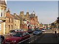
9

Former Bank Building
This unlovely building is branch of the Royal Bank of Scotland which, like the majority of branches in small communities, is now closed. That's the bank that just a handful of years ago ran a long and irritating advertising campaign based on 'not closing branches'. Thanks to them, many communities now have no bank at all. Worse, West Calder is still stuck with the building.
Image: © Anne Burgess
Taken: 19 Sep 2017
0.03 miles
