
IMAGES TAKEN NEAR TO
Monks Lane, EH54 9FZ
Introduction
This page details the photographs taken nearby to Monks Lane, EH54 9FZ by members of the Geograph project.
The Geograph project started in 2005 with the aim of publishing, organising and preserving representative images for every square kilometre of Great Britain, Ireland and the Isle of Man.

There are currently over 7.5m images from over14,400 individuals and you can help contribute to the project by visiting https://www.geograph.org.uk
Image Map
Images are licensed for reuse under creativecommons.org/licenses/by-sa/2.0
Notes
- Clicking on the map will re-center to the selected point.
- The higher the marker number, the further away the image location is from the centre of the postcode.
Image Listing (7 Images Found)
Images are licensed for reuse under creativecommons.org/licenses/by-sa/2.0
Image
Details
Distance
1

Linhouse Water railway viaduct from the air
A stone built six arch viaduct over Linthouse Glen, carrying the line from Carstairs Junction to Edinburgh. Built in 1842 by the Caledonian Railway Company, the viaduct is a Category A Listed structure http://portal.historicenvironment.scot/designation/LB7365 . Murieston is in the foreground, as is part of the Shotts line near Livingston South station.
Image: © Thomas Nugent
Taken: 27 Nov 2016
0.12 miles
2

Future Housing
Building continues apace all round Livingston. This field is one of the next to become a housing development. 4 or 5 bedroom house, prices start at £315,000.
Image: © Anne Burgess
Taken: 11 Oct 2019
0.15 miles
3

More Housing
Another field being developed for housing on the outskirts of Livingston. Prices start at £315,000 for 4 of 5 bedroom houses.
Image: © Anne Burgess
Taken: 11 Oct 2019
0.17 miles
4

Sales Office and Marketing Suite
On the left, Bellway Homes' sales office. On the right, Miller Homes' marketing suite. I cannot tell the difference, really.
Image: © Anne Burgess
Taken: 11 Oct 2019
0.18 miles
5
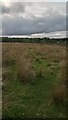
An Accidental Path?
While the tramlines shown to the right of here on the large scale map don't any longer seem to represent anything on the ground, bushes and small trees - some of which are showing at the top right of the picture - occupy the land in the middle of the lines for their entire length. The ground they occupy was part of a road a very long time ago, appearing on late 1700s and early 1800s maps, but no longer in use by the time of the first OS map from the 1850s - by then it is just shown as grass in the middle of two walls or fences.
The short grass path is presumably completely unrelated to the old road. It may just be a random coincidence, but may also have been formed by sheep and cattle on their way to get round to the other side of the bushes.
The land here is part of a very large untended field in the centre of a circular hard path route. There is a sign when entering the field from the North, warning of the dangers of livestock. I usually find these kinds of signs both bossy and unnecessary (unless warning of the presence of a bull of course). But in this case it is justified. There are often cattle in the field; combine this with the large number of people from nearby Murieston, an area of Livingston, that regularly walk their dogs round the path that circles the field - a lot of whom will not have had that much experience of walking in the country - and you have a potential problem. It must be at least a two minute jog from the centre of the field to the nearest section of path.
Image: © Ian Dodds
Taken: 24 Sep 2021
0.20 miles
6

Drain at Nether Williamson
Heading for Camilty Water.
Image: © M J Richardson
Taken: 7 Mar 2012
0.23 miles
7

Drainage pond
Beside new housing estate on edge of Livingston
Image: © Jim Smillie
Taken: 4 May 2022
0.23 miles