IMAGES TAKEN NEAR TO
Bankton Drive, LIVINGSTON, EH54 9EJ
Introduction
This page details the photographs taken nearby to Bankton Drive, EH54 9EJ by members of the Geograph project.
The Geograph project started in 2005 with the aim of publishing, organising and preserving representative images for every square kilometre of Great Britain, Ireland and the Isle of Man.

There are currently over 7.5m images from over14,400 individuals and you can help contribute to the project by visiting https://www.geograph.org.uk
Image Map
Images are licensed for reuse under creativecommons.org/licenses/by-sa/2.0
Notes
- Clicking on the map will re-center to the selected point.
- The higher the marker number, the further away the image location is from the centre of the postcode.
Image Listing (16 Images Found)
Images are licensed for reuse under creativecommons.org/licenses/by-sa/2.0
Image
Details
Distance

2

Recycle for Scotland
Glass recycling containers at the car park area for Livingston South Sports Pavilion.
Image: © M J Richardson
Taken: 13 May 2015
0.11 miles
3
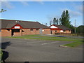
Sports club premises at Dedridge
Bankton Mains Bowling Club and Murieston United Community Football Club.
Image: © M J Richardson
Taken: 13 May 2015
0.12 miles
4
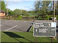
Bankton Mains Path
Leading from the Livingston South Sports Pavilion area through Bankton Mains Park northwest to Dedridge and Livingston Town Centre.
Image: © M J Richardson
Taken: 13 May 2015
0.12 miles
5
![9th West Lothian [Dedridge] Scout Group](https://s2.geograph.org.uk/geophotos/04/47/33/4473378_b712c9ad_120x120.jpg)
9th West Lothian [Dedridge] Scout Group
An improvement on the Scout 'Huts' of my youth!
Image: © M J Richardson
Taken: 13 May 2015
0.13 miles
6
Footpath off East / West Bankton Place
Image: © Alex McGregor
Taken: 16 Jun 2014
0.15 miles
7

The Re-Emergence of Dedridge Burn
There must be an incredible network of underground watercourses in Livingston. A decent amount of water flows into this burn from underneath the large Bankton Mains Park recreation park.
Dedridge Burn disappears underneath Alderstone Road nearly a mile SouthWest of here, not long after it flows through a picturesque pond. The footpath on the East side of the park roughly follows some of its former overground route so it seems likely that a steep rubbish-strewn balancing pond, also on the East side of the park, also discharges into here eventually.
Image: © Ian Dodds
Taken: 3 Mar 2021
0.16 miles
8
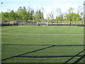
View from the goalmouth
Looking out over the artificial pitch at Murieston United CFC.
Image: © M J Richardson
Taken: 13 May 2015
0.17 miles
9

Robin's Lane
Path on the site of an estate road from before the building of Livingston.
Image: © Richard Webb
Taken: 29 May 2014
0.20 miles