
IMAGES TAKEN NEAR TO
Bankton Way, LIVINGSTON, EH54 9EG
Introduction
This page details the photographs taken nearby to Bankton Way, EH54 9EG by members of the Geograph project.
The Geograph project started in 2005 with the aim of publishing, organising and preserving representative images for every square kilometre of Great Britain, Ireland and the Isle of Man.

There are currently over 7.5m images from over14,400 individuals and you can help contribute to the project by visiting https://www.geograph.org.uk
Image Map
Images are licensed for reuse under creativecommons.org/licenses/by-sa/2.0
Notes
- Clicking on the map will re-center to the selected point.
- The higher the marker number, the further away the image location is from the centre of the postcode.
Image Listing (20 Images Found)
Images are licensed for reuse under creativecommons.org/licenses/by-sa/2.0
Image
Details
Distance

3
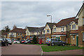
Bankton Avenue
One of many small estates making the Murieston area into a huge housing estate.
Image: © Anne Burgess
Taken: 14 Apr 2016
0.08 miles
4
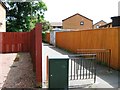
Footpath off East / West Bankton Place
Image: © Alex McGregor
Taken: 16 Jun 2014
0.10 miles
5
![9th West Lothian [Dedridge] Scout Group](https://s2.geograph.org.uk/geophotos/04/47/33/4473378_b712c9ad_120x120.jpg)
9th West Lothian [Dedridge] Scout Group
An improvement on the Scout 'Huts' of my youth!
Image: © M J Richardson
Taken: 13 May 2015
0.11 miles
6

Railway, Murieston
An embankment on the line between Edinburgh and Glasgow via Shotts, one of four rail routes now open between the two cities.
Image: © Richard Webb
Taken: 21 Feb 2012
0.12 miles
7
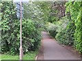
Robin's Lane
Path on the site of an estate road from before the building of Livingston.
Image: © Richard Webb
Taken: 29 May 2014
0.14 miles
8
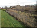
Railway line looking towards Livingstone South station
Image: © Nigel Thompson
Taken: 26 Nov 2016
0.14 miles
9

A Very Muddy Path through Old Strip Wood
I imagine this path only dries out during a major heatwave.
The narrow strip of woodland appears on the earliest OS map of the 1850s. It isn't that most of the woods round here have been felled since, just that there were very few to begin with, and most of these few remain. The larger area of trees that neighbours this one where the path leaves the park is certainly not much older than Livingston newtown itself.
If you take this path heading from Bankton Mains Park recreation park you emerge on a fairly wide tarmacked footpath. This pretty much follows a section of what was once a fairly major road - part of a route from Mid Calder to Carnwath. If you follow the tarmacked path to the left and cross over the main road it eventually leads to Bankton Lane, a short dead-end section of the original road that still remains.
Image: © Ian Dodds
Taken: 16 Mar 2021
0.16 miles
10
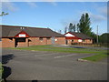
Sports club premises at Dedridge
Bankton Mains Bowling Club and Murieston United Community Football Club.
Image: © M J Richardson
Taken: 13 May 2015
0.16 miles