
IMAGES TAKEN NEAR TO
Tantallon Gardens, LIVINGSTON, EH54 9AT
Introduction
This page details the photographs taken nearby to Tantallon Gardens, EH54 9AT by members of the Geograph project.
The Geograph project started in 2005 with the aim of publishing, organising and preserving representative images for every square kilometre of Great Britain, Ireland and the Isle of Man.

There are currently over 7.5m images from over14,400 individuals and you can help contribute to the project by visiting https://www.geograph.org.uk
Image Map
Images are licensed for reuse under creativecommons.org/licenses/by-sa/2.0
Notes
- Clicking on the map will re-center to the selected point.
- The higher the marker number, the further away the image location is from the centre of the postcode.
Image Listing (9 Images Found)
Images are licensed for reuse under creativecommons.org/licenses/by-sa/2.0
Image
Details
Distance
1

Dog Roses
This picture was taken from the hard path that runs along the perimeter of Bellsquarry Wood on the other side of Tantallon Gardens, a residential street on the edge of Livingston - all the streets off the road it comes off are named after Scottish castles, possibly because there is a ruin called Murieston Castle a short distance away which, due to it being right next to some farm buildings, has yet to be photographed on this site.
I initially assumed that the flowers must have got here due to some seeds blowing across from a nearby garden. However, due to the power of plant identification apps (LeafSnap in this case) I can report that this is probably here naturally, and is in fact Britain's most common wild rose. The leaves that belong to it are the ones formed of mostly seven, but sometimes five, leaflets (the botanical term for these kind of leaves is pinnate). The name supposedly derives from an old Greek belief that the flowers were a cure for a rabid dog bite.
Image: © Ian Dodds
Taken: 12 Jun 2022
0.08 miles
2

Inside Bellsquarry Wood
Picture taken from unmarked path which leads from underpass / footpath linking the section of Alderstone Road South of A71 with Bellsquarry Village. Broadleaf wood which appears in pretty much the same shape on 1860s OS map. Marked on all maps as Bellsquarry Plantation, but the Woodland Trust refer to it as Bellsquarry Wood on their signs.
Image: © Ian Dodds
Taken: 25 Jun 2020
0.10 miles
3

Saltcoats Gardens
The current southern edge of Livingston, where there is a trend towards large houses built in former woodland or tree surrounded fields. Very well placed for the train into Edinburgh or Glasgow.
Image: © Richard Webb
Taken: 2 Oct 2008
0.15 miles
4

Longish Narrow Pond in Bellsquarry Wood
A man-made pond, formed by damming Dedridge Burn. There were people feeding ducks at the other end on the day I was there. Apparently the pond was built by the owners of Newpark House (now a nearby hotel), who used to own the land, at some stage in 19th Century.
Image: © Ian Dodds
Taken: 25 Jun 2020
0.15 miles
5

Some Comedy Art up a Tree
This was very unexpected. And due to having become conditioned to reading so much high-minded impenetrable bullsh*t alongside artworks, I have to admit it took me a little longer than it should have to realise that the accompanying write-up on the plaque below was a joke!
It reads as follows:
The Oozlum Bird - When startled this creature will take off and fly around in ever-decreasing circles until it manages to disappear completely, which adds to its rarity. Other sources state that the bird flies backwards so that it can admire its own beautiful tail feathers, or because while it does not know where it is going, it likes to know where it has been.
David Evan Mackay, Duncan of Jordanstone College of Art and Design 2014
Image: © Ian Dodds
Taken: 11 Dec 2021
0.15 miles

7

A Bright Orange Trunk
There were other trunks covered in the same stuff nearby, but none quite as vivid as this. The tree was a spindly ash, and having done a bit of online investigating I am confident enough to say that this is a type of alga as opposed to a lichen (though nowhere near confident enough to put it in the title, unlike the more knowledgeable contributors on here!) When alga becomes algae I have no idea - presumably alga are tiny and this is a collection, and therefore the picture shows algae, all belonging to the same species of alga.
The species I am plumping for here is Trentepohlia aurea, mostly because it is described as being orange and one of the most common algae found on trees in Britain and Ireland by various sources.
This was taken from quite a grassy area a short distance from one of the many official paths through this Woodland Trust wood, which for no apparent reason aren't shown on even the largest scale online maps.
Image: © Ian Dodds
Taken: 27 Jun 2022
0.16 miles
8

Bellsquarry South Road
The trees hide a few small housing estates with not so small houses. Livingston tries to do St Georges Hill (without the heavies).
Image: © Richard Webb
Taken: 2 Oct 2008
0.18 miles
9
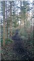
A Very Muddy Path through Old Strip Wood
I imagine this path only dries out during a major heatwave.
The narrow strip of woodland appears on the earliest OS map of the 1850s. It isn't that most of the woods round here have been felled since, just that there were very few to begin with, and most of these few remain. The larger area of trees that neighbours this one where the path leaves the park is certainly not much older than Livingston newtown itself.
If you take this path heading from Bankton Mains Park recreation park you emerge on a fairly wide tarmacked footpath. This pretty much follows a section of what was once a fairly major road - part of a route from Mid Calder to Carnwath. If you follow the tarmacked path to the left and cross over the main road it eventually leads to Bankton Lane, a short dead-end section of the original road that still remains.
Image: © Ian Dodds
Taken: 16 Mar 2021
0.21 miles