
IMAGES TAKEN NEAR TO
Lyle Green, LIVINGSTON, EH54 8QE
Introduction
This page details the photographs taken nearby to Lyle Green, EH54 8QE by members of the Geograph project.
The Geograph project started in 2005 with the aim of publishing, organising and preserving representative images for every square kilometre of Great Britain, Ireland and the Isle of Man.

There are currently over 7.5m images from over14,400 individuals and you can help contribute to the project by visiting https://www.geograph.org.uk
Image Map
Images are licensed for reuse under creativecommons.org/licenses/by-sa/2.0
Notes
- Clicking on the map will re-center to the selected point.
- The higher the marker number, the further away the image location is from the centre of the postcode.
Image Listing (10 Images Found)
Images are licensed for reuse under creativecommons.org/licenses/by-sa/2.0
Image
Details
Distance
1

Dechmont Law
Looking over Livingston. Dechmont Law is a landmark when travelling along the M8, and the centrepiece of a wild bit of parkland.
Image: © Richard Webb
Taken: 2 Sep 2004
0.07 miles
2

Oasis Christian Centre at Carmondean
Elim Church at Livingston http://www.oasischristiancentre-livingston.org.uk/ , one of many smaller churches in the area.
Image: © M J Richardson
Taken: 23 Jan 2015
0.18 miles
3

Rock outcrop
On the eastern side of Dechmont Law.
Image: © Jim Smillie
Taken: 23 Jul 2010
0.18 miles
4
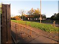
Knightsridge West Road
Some rusting pavement obstacles in Livingston.
Image: © Richard Webb
Taken: 29 Oct 2013
0.18 miles
5
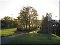
Knightsridge West Road
A distribution road in Livingston.
Image: © Richard Webb
Taken: 29 Oct 2013
0.19 miles
6

View over rooftops: Livingston
These houses must be on the highest land in Livingston.
With view to Cauldstane Slap in the Pentlands.
Image: © Jim Smillie
Taken: 23 Jul 2010
0.20 miles
7

View from Dechmont Law (2)
Towards Deer Park. Arthur's Seat and Pentlands in distance
Image: © Jim Smillie
Taken: 23 Jul 2010
0.21 miles
8
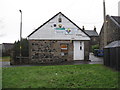
Carmondean Community Education Centre
At what seems to be a restored Nether Dechmont farm steading. Also the site of Carmondean Church, Livingston Ecumenical Parish.
Image: © M J Richardson
Taken: 23 Jan 2015
0.22 miles
9
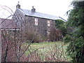
Boarded-up house at Nether Dechmont
At Carmondean, and part of the Community Education Centre, based around what looks like rehabilitated buildings of Nether Dechmont farm. This looks derelict and unloved, but is part of a quadrangle that appears fully used from the other side.
Image: © M J Richardson
Taken: 23 Jan 2015
0.23 miles
10

Camps Riggs
Terraced houses in classic council architecture style. The one on the right contains a small shop.
Image: © Anne Burgess
Taken: 7 Jan 2018
0.23 miles