
IMAGES TAKEN NEAR TO
Sutherland Way, LIVINGSTON, EH54 8JB
Introduction
This page details the photographs taken nearby to Sutherland Way, EH54 8JB by members of the Geograph project.
The Geograph project started in 2005 with the aim of publishing, organising and preserving representative images for every square kilometre of Great Britain, Ireland and the Isle of Man.

There are currently over 7.5m images from over14,400 individuals and you can help contribute to the project by visiting https://www.geograph.org.uk
Image Map
Images are licensed for reuse under creativecommons.org/licenses/by-sa/2.0
Notes
- Clicking on the map will re-center to the selected point.
- The higher the marker number, the further away the image location is from the centre of the postcode.
Image Listing (13 Images Found)
Images are licensed for reuse under creativecommons.org/licenses/by-sa/2.0
Image
Details
Distance
1
West Knightsridge.
Housing estate with added greenery. Former fields, not far from the more established greenery of an old shelterbelt.
Image: © Richard Webb
Taken: 17 Nov 2005
0.04 miles
2
Strip wood, Newyearfield
Once a shelterbelt before the fields were built upon as part of Livingston.
Image: © Richard Webb
Taken: 20 Dec 2013
0.07 miles
3
Paths converging in Sutherland Way in Knightsridge West
Image: © artful
Taken: 26 Mar 2023
0.09 miles
4
New signeage by railway bridge on Railway Path in Knightsridge West
Image: © artful
Taken: 26 Mar 2023
0.15 miles
5
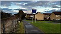
New signage on Railway Path in Knightsridge West
By railway bridge over Glasgow to Edinburgh line via Airdrie and Bathgate.
Image: © artful
Taken: 26 Mar 2023
0.16 miles
6

Lvingston from the air
A view taken from an aeroplane approaching Edinburgh Airport from the west. It is more or less centred on the Eliburn North roundabout and shows the north-west edge of the town with the West Lothian countryside beyond. The white shape of the recently rebuilt Deans Community High School can be seen beyond the roundabout.
Image: © kim traynor
Taken: 25 Jul 2012
0.18 miles
7
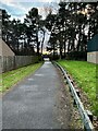
Path from Knightsbridge East to West showing underpass at Knightsbridge East Road
Image: © artful
Taken: 26 Mar 2023
0.19 miles
8
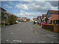
Cul de sac: Ladywell
Part of Fulmar Brae.
Image: © Jim Smillie
Taken: 23 Jul 2010
0.19 miles
9
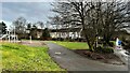
Path leading to Sutherland Way from Railway Path in Knightsridge West
Image: © artful
Taken: 26 Mar 2023
0.20 miles
10
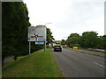
Alderstone Road, Livingston
Approaching Eliburn North Roundabout.
Image: © JThomas
Taken: 17 Sep 2021
0.21 miles