
IMAGES TAKEN NEAR TO
Sutherland Way, LIVINGSTON, EH54 8HY
Introduction
This page details the photographs taken nearby to Sutherland Way, EH54 8HY by members of the Geograph project.
The Geograph project started in 2005 with the aim of publishing, organising and preserving representative images for every square kilometre of Great Britain, Ireland and the Isle of Man.

There are currently over 7.5m images from over14,400 individuals and you can help contribute to the project by visiting https://www.geograph.org.uk
Image Map
Images are licensed for reuse under creativecommons.org/licenses/by-sa/2.0
Notes
- Clicking on the map will re-center to the selected point.
- The higher the marker number, the further away the image location is from the centre of the postcode.
Image Listing (13 Images Found)
Images are licensed for reuse under creativecommons.org/licenses/by-sa/2.0
Image
Details
Distance
1
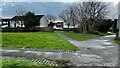
Paths converging in Sutherland Way in Knightsridge West
Image: © artful
Taken: 26 Mar 2023
0.05 miles
2
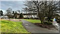
Path leading to Sutherland Way from Railway Path in Knightsridge West
Image: © artful
Taken: 26 Mar 2023
0.10 miles
3
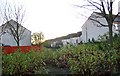
West Knightsridge.
Housing estate with added greenery. Former fields, not far from the more established greenery of an old shelterbelt.
Image: © Richard Webb
Taken: 17 Nov 2005
0.10 miles
4
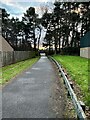
Path from Knightsbridge East to West showing underpass at Knightsbridge East Road
Image: © artful
Taken: 26 Mar 2023
0.11 miles
5
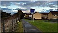
New signage on Railway Path in Knightsridge West
By railway bridge over Glasgow to Edinburgh line via Airdrie and Bathgate.
Image: © artful
Taken: 26 Mar 2023
0.13 miles
6
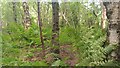
Dechmont Moss Wood
As with all woods, the fun starts when you leave the paths, or path in the case of this small wood, as there is only one, that leads from the road to a hard path running alongside the railway. Due to the fact that the road is busy and there are regular trains, the 'Blair Witch' effect is drastically reduced.
The wood gets denser the further East you go, and there is a lot of deadwood kicking about. I'm fairly sure I have mentioned this in write-ups before, but an infuriating thing about the Woodland Trust's brilliant online documents about their woods is that they split their urban woodlands into 'compartments' but never actually state where each compartment is located. This is probably 10a or 10b, and called Dechmont Moss West Wood, increasingly broadleafed due to gradual felling of 1970s-planted conifer.
I have been looking into ferns lately - it's akin to learning a foreign language. One thing I have discovered rather late in life, all things considered, is that most ferns have little dots on the underside of their leaves. These are spores which eventually fall off and due to some bewildering process eventually make new baby ferns. The spots are called sori (singular sorus), and the darker they are the closer they are to falling off. They can be seen next to the birch tree on the right of the picture, and the sori of the oldest leaves are already darkening.
Image: © Ian Dodds
Taken: 24 Jun 2022
0.13 miles
7
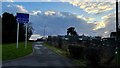
New signeage by railway bridge on Railway Path in Knightsridge West
Image: © artful
Taken: 26 Mar 2023
0.15 miles
8

Junction on Railway Path and path through Moss Wood in Knightsridge East
Image: © artful
Taken: 26 Mar 2023
0.15 miles
9

Path linking Knightsridge East to Knightsridge Industrial Estate with Cherry Plum in blossom
Image: © artful
Taken: 26 Mar 2023
0.19 miles
10
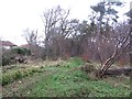
Strip wood, Newyearfield
Once a shelterbelt before the fields were built upon as part of Livingston.
Image: © Richard Webb
Taken: 20 Dec 2013
0.19 miles