
IMAGES TAKEN NEAR TO
St. Andrews Way, LIVINGSTON, EH54 8DJ
Introduction
This page details the photographs taken nearby to St. Andrews Way, EH54 8DJ by members of the Geograph project.
The Geograph project started in 2005 with the aim of publishing, organising and preserving representative images for every square kilometre of Great Britain, Ireland and the Isle of Man.

There are currently over 7.5m images from over14,400 individuals and you can help contribute to the project by visiting https://www.geograph.org.uk
Image Map
Images are licensed for reuse under creativecommons.org/licenses/by-sa/2.0
Notes
- Clicking on the map will re-center to the selected point.
- The higher the marker number, the further away the image location is from the centre of the postcode.
Image Listing (18 Images Found)
Images are licensed for reuse under creativecommons.org/licenses/by-sa/2.0
Image
Details
Distance
1
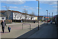
Pedestrian Precinct
The street is pedestrianised, but sadly there seems to be little reason to linger here. Almost all the shops were firmly closed and shuttered at 4 o' clock on a Tuesday afternoon.
Image: © Anne Burgess
Taken: 19 Apr 2016
0.05 miles
2
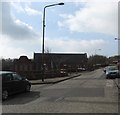
Main Street, Deans, Livingston
The west end of Deans Main Street. Deans was one of the original villages which form part of the former new town of Livingston.
Image: © James Denham
Taken: 21 Mar 2009
0.06 miles
3

St. Andrew's Church at Deans in Livingston
Image: © James Denham
Taken: 21 Mar 2009
0.09 miles
4

Livingston Station Kirk
This area of Deans is known as Livingston Station, though the railway station is long gone. The kirk was designed by Ian G Lindsay and built in 1949, and is dedicated to St Andrew. Unfortunately for photographers, the adjacent hall, built of dreary brown brick, obscures most of this side of the kirk.
Image: © Anne Burgess
Taken: 19 Apr 2016
0.10 miles
5

Community Centre
Spanking new, by the look of it, and certainly too new to feature in "The Buildings of Scotland" volume dealing with Lothian.
Image: © Anne Burgess
Taken: 19 Apr 2016
0.11 miles
6

The Masjid and Islamic Centre, Deans, Livingston
This former school in Main Street is now a mosque serving the Livingston area.
Image: © Walter Baxter
Taken: 13 Jul 2019
0.12 miles
7

Masjid and Islamic Centre
This was built in 1906 and is a typical board school of its time, with separate entrances for boys and girls. It is now a mosque serving the Livingston area.
Image: © Anne Burgess
Taken: 19 Apr 2016
0.12 miles
8
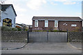
Gospel Hall
A modest building on Deans South.
Image: © Anne Burgess
Taken: 19 Apr 2016
0.14 miles
9
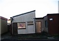
Empty house, Deans
Is this really a suitable design for a home in Scotland? Looks like voting with feet. Not far outside what was once the village of Livingston Station.
Image: © Richard Webb
Taken: 17 Nov 2005
0.14 miles
10
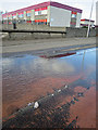
Water Power
Water from a burst main spurts up under pressure all round a paving slab in Deans South. The primary school is in the background.
Image: © Anne Burgess
Taken: 19 Apr 2016
0.16 miles