
IMAGES TAKEN NEAR TO
Caldercruix Crescent, LIVINGSTON, EH54 7FT
Introduction
This page details the photographs taken nearby to Caldercruix Crescent, EH54 7FT by members of the Geograph project.
The Geograph project started in 2005 with the aim of publishing, organising and preserving representative images for every square kilometre of Great Britain, Ireland and the Isle of Man.

There are currently over 7.5m images from over14,400 individuals and you can help contribute to the project by visiting https://www.geograph.org.uk
Image Map
Images are licensed for reuse under creativecommons.org/licenses/by-sa/2.0
Notes
- Clicking on the map will re-center to the selected point.
- The higher the marker number, the further away the image location is from the centre of the postcode.
Image Listing (15 Images Found)
Images are licensed for reuse under creativecommons.org/licenses/by-sa/2.0
Image
Details
Distance
1
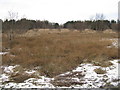
Open land at Eliburn
A haven of quiet adjacent to high density housing and roads.
Image: © M J Richardson
Taken: 19 Jan 2015
0.03 miles
2
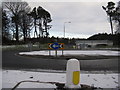
Entrance to Eliburn Park
Roundabout on Houston Road at Deans, southwest Livingston.
Image: © M J Richardson
Taken: 19 Jan 2015
0.07 miles
3
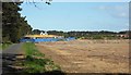
Development continues
Work continues to develop Livingston.
Image: © Jim Smillie
Taken: 12 May 2009
0.09 miles
4
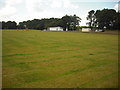
Eliburn Park
Area set aside for football pitches. Park also has play areas for various age groups.
Image: © Jim Smillie
Taken: 23 Jul 2010
0.13 miles
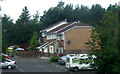
6
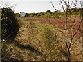
Awaiting development
Land for sale on the west of Livingston
Image: © Jim Smillie
Taken: 12 May 2009
0.17 miles
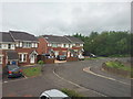
8
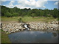
Waterfall: Eliburn Park
The burn falls all of 0.5m into the reservoir.
Image: © Jim Smillie
Taken: 23 Jul 2010
0.19 miles
9

Eliburn Reservoir
A quiet corner of this small fishery.
Image: © Jim Smillie
Taken: 23 Jul 2010
0.20 miles
10
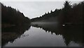
Twilight mist over Eliburn Reservoir
Whilst I know the difference between mist and fog (fog is just created by clouds being at ground level), quite why mist forms escapes me. It has something to do with water vapour (in this case from the reservoir) coming into contact with other colder passing air and turning back to water again I think! The odd thing here was that the mist only occupied the middle third of the water for whatever reason; it wasn't the case that if you moved to where the mist is in the photo, that that bit was clear close-up, and the top and bottom section looked misty.
This is now a fishery. It may always have been so as there is no water board mentioned on old maps of here, as is usually the case with
regular reservoirs. The most interesting thing I unearthed about the reservoir is that somebody had a lucky escape almost a year ago to the day when the ice gave way whilst he was doing a bit of ice hockey (?!)
Old maps indicate that the reservoir is a bit over a hundred years old.
Image: © Ian Dodds
Taken: 3 Jan 2023
0.21 miles