
IMAGES TAKEN NEAR TO
Hawk Brae, LIVINGSTON, EH54 6TW
Introduction
This page details the photographs taken nearby to Hawk Brae, EH54 6TW by members of the Geograph project.
The Geograph project started in 2005 with the aim of publishing, organising and preserving representative images for every square kilometre of Great Britain, Ireland and the Isle of Man.

There are currently over 7.5m images from over14,400 individuals and you can help contribute to the project by visiting https://www.geograph.org.uk
Image Map
Images are licensed for reuse under creativecommons.org/licenses/by-sa/2.0
Notes
- Clicking on the map will re-center to the selected point.
- The higher the marker number, the further away the image location is from the centre of the postcode.
Image Listing (14 Images Found)
Images are licensed for reuse under creativecommons.org/licenses/by-sa/2.0
Image
Details
Distance
1
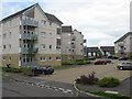
Hawk Brae at Ladywell West
Relatively new high-density housing in Livingston
Image: © M J Richardson
Taken: 7 Jun 2011
0.05 miles
2

Local shopping and housing at Hawk Brae
Relatively new housing development at Ladywell West, with essential services - next door to Farm Foods is Greggs the baker and a betting shop.
Image: © M J Richardson
Taken: 7 Jun 2011
0.06 miles
3
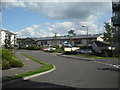
Hawk Brae Livingston
With a small row of shops.
Image: © Jim Smillie
Taken: 23 Jul 2010
0.06 miles
5
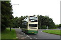
Lothian Country Bus on Alderstone Road, Livingston
Image: © JThomas
Taken: 17 Sep 2021
0.13 miles
6
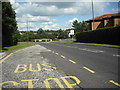
Eliburn Road
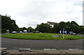
Looking to Newyearfield roundabout.
Image: © Jim Smillie
Taken: 23 Jul 2010
0.14 miles
7
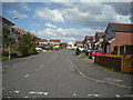
Cul de sac: Ladywell
Part of Fulmar Brae.
Image: © Jim Smillie
Taken: 23 Jul 2010
0.14 miles
8
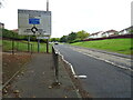
Alderstone Road, Livingston
Approaching Newyearfield Roundabout.
Image: © JThomas
Taken: 17 Sep 2021
0.16 miles
10

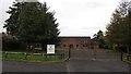
Alderstone Path
The pedestrian equivalent to Alderstone Road. It connects Deans and Livingston North railway station with St John's Hospital and the town centre.
Image: © Richard Webb
Taken: 27 Oct 2011
0.21 miles