
IMAGES TAKEN NEAR TO
Leving Place, LIVINGSTON, EH54 6ST
Introduction
This page details the photographs taken nearby to Leving Place, EH54 6ST by members of the Geograph project.
The Geograph project started in 2005 with the aim of publishing, organising and preserving representative images for every square kilometre of Great Britain, Ireland and the Isle of Man.

There are currently over 7.5m images from over14,400 individuals and you can help contribute to the project by visiting https://www.geograph.org.uk
Image Map
Images are licensed for reuse under creativecommons.org/licenses/by-sa/2.0
Notes
- Clicking on the map will re-center to the selected point.
- The higher the marker number, the further away the image location is from the centre of the postcode.
Image Listing (27 Images Found)
Images are licensed for reuse under creativecommons.org/licenses/by-sa/2.0
Image
Details
Distance
1
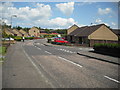
Eliburn South
Residential area near St John's Hospital
Image: © Jim Smillie
Taken: 23 Jul 2010
0.08 miles
2

Peel Park
This part of the park represents the gardens of Livigston House. According to the gazetteer for Scotland "The garden of the old mansion-house contained, about the middle of the 17th century, a large typical collection of plants, forming a sort of botanic garden, and amounting to about 1000 species-for those days a very large number. It was formed by Sir Patrick Murray of Livingston, one of the most promising men of science of his time, who died, while quite a young man, during a journey on the Continent, undertaken for the purpose of increasing his botanical knowledge. The plants were then removed to Edinburgh by Sir Andrew Balfour, and formed a large proportion of those with which the first Botanic Garden of that city-the Old Physic Gardens-was stocked in 1670".
Image: © Jim Smillie
Taken: 23 Jul 2010
0.12 miles
3

Peel of Livingston
This is the site of a fortified castle and latterly Livingston House. http://www.scotlandsplaces.gov.uk/search_item/index.php?service=RCAHMS&id=49079 .
The moat and ruins appear to be modern representations.
Image: © Jim Smillie
Taken: 23 Jul 2010
0.14 miles
4
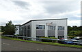
Business unit off Kirkton North Road (B7015), Livingston
Image: © JThomas
Taken: 17 Sep 2021
0.15 miles
5

Peel Path, exiting Underpass
For a few fleeting seconds there are no roads, houses, or underpasses in sight!
The path is called Peel Path because it leads, in this section anyway, directly towards Peel Park, so called because Livingston Peel used to be situated there.
This was originally a stone tower-house built in the 1100s by a Belgian noble who was given the surrounding land as a thankyou present for helping out in some long-forgotten war. His name was de Leving. And Leving's Toun became Livingston.
Image: © Ian Dodds
Taken: 24 Feb 2021
0.16 miles
6
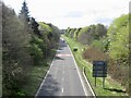
Cousland Road
A705, future proofed with room for another carriageway.
Image: © Richard Webb
Taken: 20 Apr 2022
0.16 miles
7

Livingston Village from the air
Kirkton North is in the foreground, Kirkton South in the distance.
Image: © Thomas Nugent
Taken: 13 Jul 2012
0.16 miles
8

Open space, Jackson Place
Undeveloped green space, Livingston.
Image: © Richard Webb
Taken: 31 Oct 2011
0.16 miles
9

Convenience store, Alderstone Road
The entrance is on the left (in shadow).
Image: © Richard Webb
Taken: 20 Apr 2022
0.16 miles
10
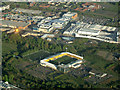
Almondvale Stadium from the air
Home of Livingston FC, sponsored by Motorola. On approach to Edinburgh Airport from the west.
Image: © Thomas Nugent
Taken: 24 May 2013
0.17 miles