
IMAGES TAKEN NEAR TO
Almondvale Lane, LIVINGSTON, EH54 6GL
Introduction
This page details the photographs taken nearby to Almondvale Lane, EH54 6GL by members of the Geograph project.
The Geograph project started in 2005 with the aim of publishing, organising and preserving representative images for every square kilometre of Great Britain, Ireland and the Isle of Man.

There are currently over 7.5m images from over14,400 individuals and you can help contribute to the project by visiting https://www.geograph.org.uk
Image Map
Images are licensed for reuse under creativecommons.org/licenses/by-sa/2.0
Notes
- Clicking on the map will re-center to the selected point.
- The higher the marker number, the further away the image location is from the centre of the postcode.
Image Listing (35 Images Found)
Images are licensed for reuse under creativecommons.org/licenses/by-sa/2.0
Image
Details
Distance
1
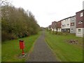
Path, Dedridge
Behind the Falconer Rise flats.
Image: © Richard Webb
Taken: 4 May 2016
0.07 miles
2
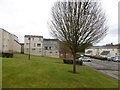
Tree, Falconer Rise
Spent time here trying to catch a friendly but quick dog who had decided to come along for a run. The grass slope drops towards the Dedridge Burn and River Almond.
Image: © Richard Webb
Taken: 4 May 2016
0.10 miles
3
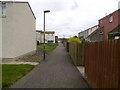
Path off Herald Rise
One of Livvy's maze of paths.
Image: © Richard Webb
Taken: 4 May 2016
0.10 miles
4
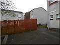
Herald Rise, Dedridge
A maze of paths linking small greens, often with doors opening directly on to them is a feature of Livingston.
Image: © Richard Webb
Taken: 4 May 2016
0.14 miles

6

Rough parkland, Livingston
This looks like an old road, and before Livingston, a Midlothian adopted road ran through here parallel with the River Almond. The road has been grassed over and replaced by a modern road to the south.
Image: © Richard Webb
Taken: 25 Mar 2015
0.15 miles
7

ASDA WAL*MART
Superstore entrance at Almondvale. At the eastern end of the complex.
Image: © M J Richardson
Taken: 20 Dec 2009
0.16 miles
8
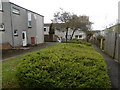
Clement Rise
In the path network behind Clement Rise, Livingston.
Image: © Richard Webb
Taken: 4 May 2016
0.18 miles
9
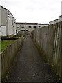
Path, Howard Rise
There are rumours of bands of lost postmen, meter readers and evangelists still roaming the paths of Livingston, still seeking the way out.
Image: © Richard Webb
Taken: 4 May 2016
0.18 miles
10

Howden Bridge over the River Almond
On the eastern outskirts of Livingston, this bridge once carried the main Edinburgh-Kilmarnock Road. The A899 bridge is just visible beyond it.
Image: © M J Richardson
Taken: 20 Dec 2009
0.18 miles