
IMAGES TAKEN NEAR TO
Forestbank, LIVINGSTON, EH54 6DU
Introduction
This page details the photographs taken nearby to Forestbank, EH54 6DU by members of the Geograph project.
The Geograph project started in 2005 with the aim of publishing, organising and preserving representative images for every square kilometre of Great Britain, Ireland and the Isle of Man.

There are currently over 7.5m images from over14,400 individuals and you can help contribute to the project by visiting https://www.geograph.org.uk
Image Map
Images are licensed for reuse under creativecommons.org/licenses/by-sa/2.0
Notes
- Clicking on the map will re-center to the selected point.
- The higher the marker number, the further away the image location is from the centre of the postcode.
Image Listing (15 Images Found)
Images are licensed for reuse under creativecommons.org/licenses/by-sa/2.0
Image
Details
Distance


5

Livingston Road.
A899, the spine road of Livingston. The town is accessed by a series of cloverleaf junctions, this being one of them, Cousland. It the distance is Cauldstane Slap, the gap in the Pentland Hills taken by the Thieves Road - between East Cairn Hill and West Cairn Hill.
Image: © Richard Webb
Taken: 17 Nov 2005
0.15 miles


8

Livingston from the air
Livingston Road is prominent in this view.
Image: © Thomas Nugent
Taken: 26 Apr 2013
0.19 miles
9

Flats, Calgary Avenue
Named after Calgary, Alberta as all street names here are Canadian themed.
Image: © Richard Webb
Taken: 12 Oct 2022
0.20 miles
10
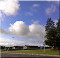
Broken lamppost / streetlight on A899 Livingston Road
Oops. Perhaps they're not 'frangible' as I had first suggested back in June of this year (See http://www.geograph.org.uk/discuss/index.php?&action=vthread&forum=5&topic=7751&page=0#3 ), as they seem still to stand up after they're whacked.
(Maybe it's just me but I feel that there has been an alarming increase in injury and death due to lamp post collisions in recent years. Maybe it's just that this road has had more than its fair share and that's why it has my attention.)
The A899 in Livingston (Dual carriageway) has had its speed reduced to 50mph after a spate of them. The Council have recently replaced the lamp standards on the road and I wonder that they might be of the new generation of passive safety columns which are designed to be a bit more crash friendly.
And 30mph speed limits when there are temporary roadworks http://www.geograph.org.uk/photo/80088
There are a number of products available on the market which are intended to make our travelling safer. http://www.thepassiverevolution.co.uk/products.html
One of the types of products I do think we'll be seeing a lot more of is the frangible post type http://solutions.3m.co.uk/wps/portal/3M/en_GB/Traffic-Safety-Systems/Traffic-Safety-Systems/News-Events/Product-News/?PC_7_RJH9U5230GE3E02LECIE208T41_assetId=1180584271635 which I believe could make a major contribution to road safety. This type simply disintegrates on impact. If the link doesn't work then click on Frangible Post System on this page http://solutions.3m.co.uk/wps/portal/3M/en_GB/Traffic-Safety-Systems/Traffic-Safety-Systems/News-Events/Product-News/
These are making their debut http://solutions.3m.co.uk/wps/portal/3M/en_GB/Traffic-Safety-Systems/Traffic-Safety-Systems/Safety-Solutions/Road-Authorities/Passive-Safety/M54 on the M6 and M54.
DESIGN MANUAL FOR ROADS AND BRIDGES PART 2 TA 89/05 USE OF PASSIVELY SAFE SIGNPOSTS, LIGHTING COLUMNS AND TRAFFIC SIGNAL POSTS TO BS EN 12767
In reality there are a lot more folk hitting trees and they can't be redesigned quite so easily. The Facts: http://www.thepassiverevolution.co.uk/factsfigures.html
Do take care.
Other Reference site: http://www.brake.org.uk/
Damaged lighting and faults can be reported to the Council http://www.westlothian.gov.uk/1523/1284/1302/1309
Oops, there goes another one: http://www.geograph.org.uk/photo/990599 Both fixed and repaired by Wed 15th Oct 2008.
Image: © Simon Johnston
Taken: 4 Sep 2008
0.20 miles