
IMAGES TAKEN NEAR TO
Cloverbank, LIVINGSTON, EH54 6DS
Introduction
This page details the photographs taken nearby to Cloverbank, EH54 6DS by members of the Geograph project.
The Geograph project started in 2005 with the aim of publishing, organising and preserving representative images for every square kilometre of Great Britain, Ireland and the Isle of Man.

There are currently over 7.5m images from over14,400 individuals and you can help contribute to the project by visiting https://www.geograph.org.uk
Image Map
Images are licensed for reuse under creativecommons.org/licenses/by-sa/2.0
Notes
- Clicking on the map will re-center to the selected point.
- The higher the marker number, the further away the image location is from the centre of the postcode.
Image Listing (17 Images Found)
Images are licensed for reuse under creativecommons.org/licenses/by-sa/2.0
Image
Details
Distance


6

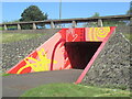
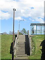
As it was in 1992
Link road between Howden West Road and Ladywell East Road as it crosses Cousland Road (A705) on an overbridge.
Image: © Carol Walker
Taken: Unknown
0.16 miles

8

Howden Park from the air
Seen on approach to Edinburgh Airport from the west.
Image: © Thomas Nugent
Taken: 16 May 2019
0.19 miles
9
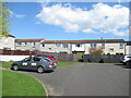
Burnbank, Livingston
A path under the houses leads to a bus stop.
Image: © Richard Webb
Taken: 20 Apr 2022
0.19 miles
10

Path of Howley Avenue
The Howden policy woodlands survive (trees on the left).
Image: © Richard Webb
Taken: 12 Oct 2022
0.19 miles