
IMAGES TAKEN NEAR TO
Marrfield Road, LIVINGSTON, EH54 5QE
Introduction
This page details the photographs taken nearby to Marrfield Road, EH54 5QE by members of the Geograph project.
The Geograph project started in 2005 with the aim of publishing, organising and preserving representative images for every square kilometre of Great Britain, Ireland and the Isle of Man.

There are currently over 7.5m images from over14,400 individuals and you can help contribute to the project by visiting https://www.geograph.org.uk
Image Map
Images are licensed for reuse under creativecommons.org/licenses/by-sa/2.0
Notes
- Clicking on the map will re-center to the selected point.
- The higher the marker number, the further away the image location is from the centre of the postcode.
Image Listing (28 Images Found)
Images are licensed for reuse under creativecommons.org/licenses/by-sa/2.0
Image
Details
Distance
1
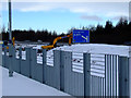
Uphall railway station
By the M8 motorway which can be seen in the background.
Image: © Thomas Nugent
Taken: 9 Jan 2011
0.04 miles
2
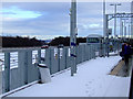
Uphall railway station
By the M8 motorway which can be seen to the left.
Image: © Thomas Nugent
Taken: 9 Jan 2011
0.04 miles
3
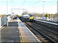
Uphall Railway Station
Uphall railway station is about half a mile south of Uphall in West Lothian. It is the station between Livingston North and Edinburgh Park railway stations on the North Clyde Line.
Image: © G Laird
Taken: 11 Nov 2017
0.04 miles
4
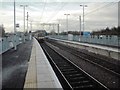
Heading to Bathgate
From December 2010 with the re-opening of the line west of Bathgate trains will head towards Airdrie and Glasgow.
Image: © Jim Smillie
Taken: 25 Nov 2010
0.04 miles
5
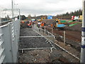
On-going work at Uphall Station
Possibly for parking on the Edinburgh bound platform side.
Image: © Jim Smillie
Taken: 25 Nov 2010
0.04 miles
6
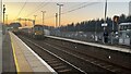
Class 334 Scotrail trains passing at Uphall Station
Two class 334 Scotrail trains pass at Uphall on the Edinburgh to Helensburgh via Bathgate line. Westbound train for Milngavie and other for Edinburgh.
Image: © artful
Taken: 13 Feb 2023
0.05 miles
7

Shelter, Uphall Station
New shelter, part of a massive renovation of the station.
Image: © Richard Webb
Taken: 25 Mar 2009
0.05 miles
8

Uphall Station
Path approaching the Edinburgh bound platform. There has been a large amount of work done here recently, lots of new paths and fences.
Image: © Richard Webb
Taken: 25 Mar 2009
0.05 miles
9
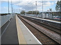
Uphall railway station, West Lothian
Opened in 1849 by the Edinburgh & Bathgate Railway, later part of the North British Railway empire, this station closed in 1956. It was rebuilt and reopened in 1986 when the Bathgate line was reopened to passengers, and electrified in 2010 when the line was reopened to Coatbridge and Glasgow.
View east towards Drumshoreland and Edinburgh.
Image: © Nigel Thompson
Taken: 12 Apr 2011
0.05 miles
10

Uphall Station from over Pumpherston
The village was named after the original station which closed many years ago but, with the reopening of the Edinburgh-Bathgate-Airdrie-Helensburgh line a new station was built and it can just be made out between the houses and the M8. The road on the left passing under the motorway is the B8046 Pumpherston Road.
Image: © M J Richardson
Taken: 7 Apr 2016
0.06 miles