
IMAGES TAKEN NEAR TO
Nasmyth Square, LIVINGSTON, EH54 5GG
Introduction
This page details the photographs taken nearby to Nasmyth Square, EH54 5GG by members of the Geograph project.
The Geograph project started in 2005 with the aim of publishing, organising and preserving representative images for every square kilometre of Great Britain, Ireland and the Isle of Man.

There are currently over 7.5m images from over14,400 individuals and you can help contribute to the project by visiting https://www.geograph.org.uk
Image Map
Images are licensed for reuse under creativecommons.org/licenses/by-sa/2.0
Notes
- Clicking on the map will re-center to the selected point.
- The higher the marker number, the further away the image location is from the centre of the postcode.
Image Listing (11 Images Found)
Images are licensed for reuse under creativecommons.org/licenses/by-sa/2.0
Image
Details
Distance
1
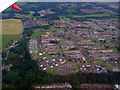
Craigshill from the air
Craigshill Care Facility on Larch Grove can be seen near the bottom of the photo.
Image: © Thomas Nugent
Taken: 13 Jul 2012
0.13 miles
2

Industrial Estate at Livingston
A path through the Grange Road estate.
Image: © M J Richardson
Taken: 16 Apr 2010
0.13 miles
3
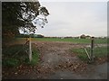
Craigshill High School playing fields
Still signposted as Craigshill High School, although the school closed in 1992 and most of its buildings demolished.
Image: © Richard Webb
Taken: 28 Oct 2013
0.19 miles
4

Grange Road
Industrial estate, Livingston.
Image: © Richard Webb
Taken: 16 Jan 2014
0.20 miles
5
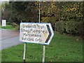
Old sign
Craigshill High School closed in 1992, and this sign looks as if it is of that era.
Image: © Richard Webb
Taken: 28 Oct 2013
0.21 miles
6
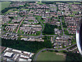
Craigshill from the air
The fire station can be seen at the bottom of the photo, immediately in front of the aircraft engine.
Image: © Thomas Nugent
Taken: 27 Jun 2014
0.21 miles
7

Craigs Strip
An old woodland in Livingston, shown on mid 19th century maps. Much of the land that Livinston was built upon was a mix of farms and small woods. Some of the woods have survived.
Image: © Richard Webb
Taken: 28 Oct 2013
0.21 miles
8

Grange Road, Livingston
A familiar scene on an industrial estate - large buildings, fences, and parked cars.
Image: © M J Richardson
Taken: 16 Apr 2010
0.22 miles
9
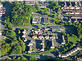
Livingston fire station from the air
Seen on approach to Edinburgh Airport from the west.
Image: © Thomas Nugent
Taken: 16 May 2019
0.23 miles
10
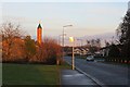
Craigshill East Road
Passing a mosque.
Image: © Richard Webb
Taken: 16 Jan 2014
0.23 miles