
IMAGES TAKEN NEAR TO
Cannel Gardens, EH54 5FJ
Introduction
This page details the photographs taken nearby to Cannel Gardens, EH54 5FJ by members of the Geograph project.
The Geograph project started in 2005 with the aim of publishing, organising and preserving representative images for every square kilometre of Great Britain, Ireland and the Isle of Man.

There are currently over 7.5m images from over14,400 individuals and you can help contribute to the project by visiting https://www.geograph.org.uk
Image Map
Images are licensed for reuse under creativecommons.org/licenses/by-sa/2.0
Notes
- Clicking on the map will re-center to the selected point.
- The higher the marker number, the further away the image location is from the centre of the postcode.
Image Listing (17 Images Found)
Images are licensed for reuse under creativecommons.org/licenses/by-sa/2.0
Image
Details
Distance
1

Street corner, Houston Road
Uphall Station after a small snowfall.
Image: © Richard Webb
Taken: 10 Feb 2009
0.11 miles
2

Uphall Station from over Pumpherston
The village was named after the original station which closed many years ago but, with the reopening of the Edinburgh-Bathgate-Airdrie-Helensburgh line a new station was built and it can just be made out between the houses and the M8. The road on the left passing under the motorway is the B8046 Pumpherston Road.
Image: © M J Richardson
Taken: 7 Apr 2016
0.15 miles
3

Pumpherston Road entering Uphall Station
Originally a small village south of Uphall where a railway station was opened in the mid 19th century to serve the important oil shale industry. Like many of the so-called villages in this area it has been subsumed into the Livingstone conurbation,
Image: © Tim Heaton
Taken: 3 Jul 2018
0.16 miles
4

Houston Industrial Estate
Outside Empteezy Limited - they make spill kits and spill containment products.
Image: © Richard Webb
Taken: 29 Oct 2013
0.22 miles
5
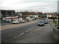
Pumpherston Road: Uphall Station
The railway bridge has been replaced as part of the upgrading of the line Image
Image: © Jim Smillie
Taken: 25 Nov 2010
0.22 miles
6

Shelter, Uphall Station
New shelter, part of a massive renovation of the station.
Image: © Richard Webb
Taken: 25 Mar 2009
0.23 miles
7

Uphall Station and the M8 from the air
Uphall railway station platform can be seen to the left of the motorway at the bottom of the photo. See the station at ground level earlier the same day here Image & Image
Image: © Thomas Nugent
Taken: 9 Jan 2011
0.23 miles
8

Uphall Station
Newly renovated. Looking towards Edinburgh.
Image: © Richard Webb
Taken: 25 Mar 2009
0.23 miles
9
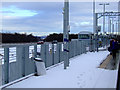
Uphall railway station
By the M8 motorway which can be seen to the left.
Image: © Thomas Nugent
Taken: 9 Jan 2011
0.23 miles
10
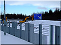
Uphall railway station
By the M8 motorway which can be seen in the background.
Image: © Thomas Nugent
Taken: 9 Jan 2011
0.23 miles