
IMAGES TAKEN NEAR TO
Darnell Road, EDINBURGH, EH5 3PH
Introduction
This page details the photographs taken nearby to Darnell Road, EH5 3PH by members of the Geograph project.
The Geograph project started in 2005 with the aim of publishing, organising and preserving representative images for every square kilometre of Great Britain, Ireland and the Isle of Man.

There are currently over 7.5m images from over14,400 individuals and you can help contribute to the project by visiting https://www.geograph.org.uk
Image Map
Images are licensed for reuse under creativecommons.org/licenses/by-sa/2.0
Notes
- Clicking on the map will re-center to the selected point.
- The higher the marker number, the further away the image location is from the centre of the postcode.
Image Listing (53 Images Found)
Images are licensed for reuse under creativecommons.org/licenses/by-sa/2.0
Image
Details
Distance

2
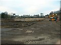
Trinity House
The old HQ of the Common Services Agency is now just a bare site awaiting the arrival of the new homes which will be known as Trinity Gardens.
http://www.trinity-gardens.com
A pic during the demolition of the old building: http://www.geograph.org.uk/photo/343014
Image: © Simon Johnston
Taken: 18 Dec 2007
0.08 miles
3
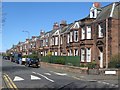
Terraced houses, South Trinity Road, Edinburgh
A nicely built terrace of houses on the eastern side of South Trinity Road.
Image: © Graham Robson
Taken: 18 Apr 2015
0.09 miles
4
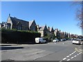
Stirling Road, Edinburgh
Looking along Stirling Road in the Trinity area of Edinburgh.
Image: © Graham Robson
Taken: 18 Apr 2015
0.10 miles
5

Trinity Park
New houses, the Ordnance Survey had a trigonometric station here once described as Trinity College Flagstaff here.
Image: © Richard Webb
Taken: 10 Jan 2016
0.10 miles
6
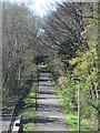
Cyclepath viewed from South Trinity Road, Edinburgh
A modern footpath and cycleway now follows the alignment of a former railway line crossing under South Trinity Road.
Image: © Graham Robson
Taken: 18 Apr 2015
0.10 miles
7
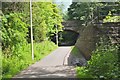
South Trinity Road bridge over cycleway
A bridge and ramp from the cyclepath to Leith.
Image: © Jim Barton
Taken: 23 Jun 2016
0.10 miles
8
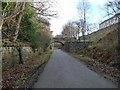
South Trinity Road bridge, from the west
Crossing a former railway line, now a cycleway and footpath.
Image: © Christine Johnstone
Taken: 5 Feb 2014
0.11 miles
9

Trinity Park housing development, Edinburgh
A housing development that appears to have recently reached completion and is now mostly occupied (judging by cars on driveways). The development consists of rows of 3 and 4 storey terraced town houses.
Image: © Graham Robson
Taken: 18 Apr 2015
0.12 miles
10
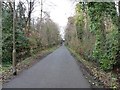
Looking west towards South Trinity Road bridge
This former railway from Leith opened in 1864. It is now a cycleway and footpath.
Image: © Christine Johnstone
Taken: 5 Feb 2014
0.13 miles