
IMAGES TAKEN NEAR TO
Braeside Park, LIVINGSTON, EH53 0TA
Introduction
This page details the photographs taken nearby to Braeside Park, EH53 0TA by members of the Geograph project.
The Geograph project started in 2005 with the aim of publishing, organising and preserving representative images for every square kilometre of Great Britain, Ireland and the Isle of Man.

There are currently over 7.5m images from over14,400 individuals and you can help contribute to the project by visiting https://www.geograph.org.uk
Image Map
Images are licensed for reuse under creativecommons.org/licenses/by-sa/2.0
Notes
- Clicking on the map will re-center to the selected point.
- The higher the marker number, the further away the image location is from the centre of the postcode.
Image Listing (12 Images Found)
Images are licensed for reuse under creativecommons.org/licenses/by-sa/2.0
Image
Details
Distance
1
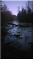
Pond near Calder House, Mid Calder
Definitely once part of the Calder House grounds, and probably still officially belongs to the house, though these days the area is obviously often used by the public for walking their dogs . There are low wall remains from a fairly substantial building at the NorthEast corner of the pond, but no clues from older maps as to what it once was. Calder House is so old that it's original incarnation actually seems to predate all written records.
Image: © Ian Dodds
Taken: 16 Jan 2021
0.11 miles
2
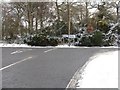
Road Junction between Mid Calder and Livingston
Viewed from the road from Howden Bridge, which carried the old A road west to Whitburn. The road to the left [now B8046] goes to Mid Calder, part of that same road. The road to the right is relatively recent and is now the main route west from Mid Calder to Livingston, through new housing estates.
Image: © M J Richardson
Taken: 20 Dec 2009
0.12 miles
3
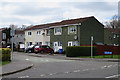
Ochiltree Crescent
One of the residential areas on the outskirts of Livingston.
Image: © Anne Burgess
Taken: 14 Apr 2016
0.18 miles
4
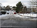
Calderhouse Road
Newish housing on the western outskirts of Mid Calder, off the B8046.
Image: © M J Richardson
Taken: 20 Dec 2009
0.19 miles
5
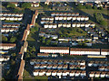
Livingston from the air
Seen on final approach to Edinburgh from the west.
Image: © Thomas Nugent
Taken: 28 Jun 2018
0.20 miles
6
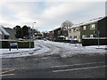
Ochiltree Crescent, Midcalder
Part of a westward expansion of Midcalder towards Livingston that has occurred over the last 20 years.
Image: © M J Richardson
Taken: 20 Dec 2009
0.20 miles
7

River Almond
Lovely riverside woodland walk
Image: © Alasdair MacNeill
Taken: 19 May 2019
0.22 miles
8
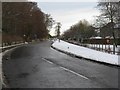
Main Street, Mid Calder
Now a quiet unclassified road through modern housing, this was once the A71 main road from Edinburgh westwards to Kilmarnock.
Image: © M J Richardson
Taken: 20 Dec 2009
0.24 miles
9

Ex-paper mill at Mid Calder.
On the banks of the River Almond. Now available for letting as industrial units.
Image: © M J Richardson
Taken: 20 Dec 2009
0.24 miles
10

River Almond
Looking down at the River Almond from the top of a ridge eaten away over time by the water.
Image: © Alasdair MacNeill
Taken: 30 Sep 2012
0.24 miles