
IMAGES TAKEN NEAR TO
Tennent Park, LIVINGSTON, EH53 0RF
Introduction
This page details the photographs taken nearby to Tennent Park, EH53 0RF by members of the Geograph project.
The Geograph project started in 2005 with the aim of publishing, organising and preserving representative images for every square kilometre of Great Britain, Ireland and the Isle of Man.

There are currently over 7.5m images from over14,400 individuals and you can help contribute to the project by visiting https://www.geograph.org.uk
Image Map
Images are licensed for reuse under creativecommons.org/licenses/by-sa/2.0
Notes
- Clicking on the map will re-center to the selected point.
- The higher the marker number, the further away the image location is from the centre of the postcode.
Image Listing (11 Images Found)
Images are licensed for reuse under creativecommons.org/licenses/by-sa/2.0
Image
Details
Distance
1
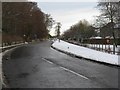
Main Street, Mid Calder
Now a quiet unclassified road through modern housing, this was once the A71 main road from Edinburgh westwards to Kilmarnock.
Image: © M J Richardson
Taken: 20 Dec 2009
0.13 miles
2

Midcalder Primary School
Some way out of the old village, but handy for the extensive new housing development that has occurred over the last 20 years.
Image: © M J Richardson
Taken: 11 Sep 2010
0.13 miles
3
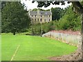
Calder House
The home of the Sandilands, the Lords Torphichen, seen across the playing field of the primary school.
Image: © M J Richardson
Taken: 11 Sep 2010
0.15 miles
6
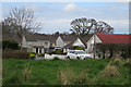
Spottiswoode Gardens
Spottiswoode Gardens consists of a main drive and several spurs, all of them culs-de-sac. The path along the bank above the Murieston Water passes along to the south, and this is looking north from that path.
Image: © Anne Burgess
Taken: 14 Apr 2016
0.20 miles
7

Waymark
At this point a path leaves the route above the left bank of Murieston Water and descends to a footbridge giving access to Calderwood.
Image: © Anne Burgess
Taken: 14 Apr 2016
0.22 miles
8
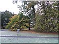
Woodland, Caroline Gardens
Some woodland which has survived the building of Livingston.
Image: © Richard Webb
Taken: 5 Nov 2013
0.23 miles

10

East Lodge and Gateway
This is the east entrance to Calder House. The elaborate gateway dates from 1670. Shame about the yellow plastic bin smack beside it.
Image: © Anne Burgess
Taken: 14 Apr 2016
0.25 miles