
IMAGES TAKEN NEAR TO
Erskine Place, LIVINGSTON, EH53 0LU
Introduction
This page details the photographs taken nearby to Erskine Place, EH53 0LU by members of the Geograph project.
The Geograph project started in 2005 with the aim of publishing, organising and preserving representative images for every square kilometre of Great Britain, Ireland and the Isle of Man.

There are currently over 7.5m images from over14,400 individuals and you can help contribute to the project by visiting https://www.geograph.org.uk
Image Map
Images are licensed for reuse under creativecommons.org/licenses/by-sa/2.0
Notes
- Clicking on the map will re-center to the selected point.
- The higher the marker number, the further away the image location is from the centre of the postcode.
Image Listing (19 Images Found)
Images are licensed for reuse under creativecommons.org/licenses/by-sa/2.0
Image
Details
Distance
1

The B8046 (Uphall Station Road) entering Pumpherston, "The Historic Centre of Shale Oil Industry"
The recovery of oil from shale was an important industry in 19th century Scotland, and the entrance signs proudly declare Pumpherston to be "The Historic Centre of Shale Oil Industry"
The Scottish parliament has decided to ban any future shale hydrocarbon recovery https://www.ineos.com/businesses/ineos-shale/news/shale-gas-ban-a-blow-to-scotland/
Image: © Tim Heaton
Taken: 3 Jul 2018
0.06 miles
2
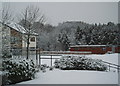
Snowy day, Craigshill, Livingston
Modern housing against a winter backdrop. Livingston Pentecostal Church is on the right.
Image: © Colin Kerr
Taken: 23 Feb 2005
0.17 miles
3

South Village
A collection of parallel streets of single story houses. Probably built to accommodate workers in the shale mines.
Image: © Richard Webb
Taken: 10 Feb 2009
0.17 miles
4

Pumpherston South Village
"Constructed to the south of the earlier Pumpherston North Village to house staff of the Pumpherston Oil Works" https://www.scottishshale.co.uk/GazVillages/PumpherstonSVillage.html
Image: © Tim Heaton
Taken: 3 Jul 2018
0.18 miles
5

Woodland, South Village
Like many of the woods in Livingston, this is managed by the Woodland Trust.
Image: © Richard Webb
Taken: 10 Feb 2009
0.18 miles
6

East Woods, Craigshill, Livingston
I don't think it would cause much argument to describe Craigshill as an unglamorous area of an unglamorous town. However, as with all of Livingston, it is close to a good network of leafy paths, and due to the town sloping down from North to South, has stunning views of the Pentland Hills from certain spots, including an open section on this linear woodland route.
There is easy access to the wood via a tarmac path leading from Nasmyth Square, a dead-end road leading to lots of small industrial units with lots of parking space. Presumably the name arises from the woods being on the East side of Livingston, and the main mostly tarmacked path swings round Craigshill's NorthEastern corner, with access from various residential streets and the Mid Calder to Pumpherston road.
Like most of Livingston's many small woodlands it is managed by the Woodland Trust, who have enormous exhaustive files available online about all of their sites. The only gripe I have with these reports is that they generally split up these suburban woodlands into 'compartments', with no accompanying map to determine where these compartments are on the ground. This time though it was easy enough to figure them out. This Northern section is mixed, and was originally planted in the mid 1800s. The Southernmost section though, in the neighbouring grid-square, is thought to have been planted during the building of Livingston, which mostly started with Craigshill in the 1960s. I mention this because the Woodland Trust report mentions problems there with various species of conifer having got too tall and therefore blowing over a lot. I wonder if they aren't present in the older section because these tree types weren't readily available at that time, they have already all blown over and/or been felled, or whether it is just a case of humanity becoming increasingly more stupid over time?!
Image: © Ian Dodds
Taken: 20 Nov 2021
0.19 miles
7

South Village, Pumpherston
Two of the parallel rows of single storey houses, probably associated with the oilshale industry.
Image: © Richard Webb
Taken: 10 Feb 2009
0.20 miles
8

Coal Sheds
Each of the cottages in South Village had a coal shed at the end of the block. Unlike the houses, many of the coal sheds have survived more or less unaltered.
Image: © Anne Burgess
Taken: 18 Nov 2016
0.20 miles

10

South Village
The streets in South Village are possibly the only part of Pumpherston that would still be recognised by the shale miners and oils workers who lived here in the heyday of the shale oil industry, but even here many of the cottages have been altered or replaced.
Image: © Anne Burgess
Taken: 18 Nov 2016
0.21 miles