
IMAGES TAKEN NEAR TO
Sandiland Drive, LIVINGSTON, EH53 0LD
Introduction
This page details the photographs taken nearby to Sandiland Drive, EH53 0LD by members of the Geograph project.
The Geograph project started in 2005 with the aim of publishing, organising and preserving representative images for every square kilometre of Great Britain, Ireland and the Isle of Man.

There are currently over 7.5m images from over14,400 individuals and you can help contribute to the project by visiting https://www.geograph.org.uk
Image Map
Images are licensed for reuse under creativecommons.org/licenses/by-sa/2.0
Notes
- Clicking on the map will re-center to the selected point.
- The higher the marker number, the further away the image location is from the centre of the postcode.
Image Listing (11 Images Found)
Images are licensed for reuse under creativecommons.org/licenses/by-sa/2.0
Image
Details
Distance
1
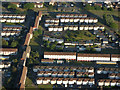
Livingston from the air
Seen on final approach to Edinburgh from the west.
Image: © Thomas Nugent
Taken: 28 Jun 2018
0.06 miles
2
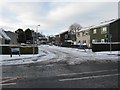
Ochiltree Crescent, Midcalder
Part of a westward expansion of Midcalder towards Livingston that has occurred over the last 20 years.
Image: © M J Richardson
Taken: 20 Dec 2009
0.09 miles
3
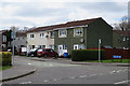
Ochiltree Crescent
One of the residential areas on the outskirts of Livingston.
Image: © Anne Burgess
Taken: 14 Apr 2016
0.09 miles
4
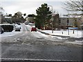
Calderhouse Road
Newish housing on the western outskirts of Mid Calder, off the B8046.
Image: © M J Richardson
Taken: 20 Dec 2009
0.12 miles
5
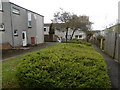
Clement Rise
In the path network behind Clement Rise, Livingston.
Image: © Richard Webb
Taken: 4 May 2016
0.18 miles
6
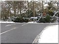
Road Junction between Mid Calder and Livingston
Viewed from the road from Howden Bridge, which carried the old A road west to Whitburn. The road to the left [now B8046] goes to Mid Calder, part of that same road. The road to the right is relatively recent and is now the main route west from Mid Calder to Livingston, through new housing estates.
Image: © M J Richardson
Taken: 20 Dec 2009
0.20 miles
7
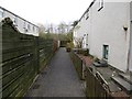
Path, Clement Rise
A dead end, the A899 lurks beyond the woods in the background.
Image: © Richard Webb
Taken: 4 May 2016
0.21 miles
8
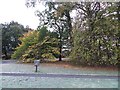
Woodland, Caroline Gardens
Some woodland which has survived the building of Livingston.
Image: © Richard Webb
Taken: 5 Nov 2013
0.21 miles
9
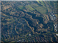
Calder Wood from the air
The scars of Murieston Water (neraest camera) and Linhouse Water can be seen running through the wood.
Image: © Thomas Nugent
Taken: 16 Dec 2018
0.22 miles
10
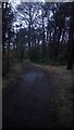
Path through Lizzie Brice's Strip
This path is strangely unmarked on all maps, as are a few other paths in this narrow stretch of woodland.
Lizzie Brice (actually Bryce when she was alive) must have been something of a local character - she died in 1865, aged 89, but by 1895 these trees had already been named after her. Contrary to popular belief she was not a witch and in fact spent most of her life married, and had a number of children. Somewhat sketchy historical surmising leads those that have looked into it in more detail to state that she was probably a tall no-nonsense woman, who lost it a bit in her later years. The fact that it is known she took in female orphans from poor-houses when a widow in her 80s must only have added to her formidable reputation, as these girls must no doubt have had a few good first-hand stories to tell! She and her husband used to have a few cattle which they would let roam the wood that now takes her name.
She lived and died in Raw Cottage, which no longer exists, but can be seen on old OS maps (it is easiest to figure things out by overlaying maps on the great NLS website). It was situated just North of the gates at the entrance to the big electricity distribution station, which put it at the corner of a T-junction of what would have been two fairly major roads in their time. The Northern section of the wood is called Raw Strip, and both are maintained by community volunteers.
Image: © Ian Dodds
Taken: 23 Feb 2021
0.22 miles