
IMAGES TAKEN NEAR TO
Renwick Court, LIVINGSTON, EH53 0GR
Introduction
This page details the photographs taken nearby to Renwick Court, EH53 0GR by members of the Geograph project.
The Geograph project started in 2005 with the aim of publishing, organising and preserving representative images for every square kilometre of Great Britain, Ireland and the Isle of Man.

There are currently over 7.5m images from over14,400 individuals and you can help contribute to the project by visiting https://www.geograph.org.uk
Image Map
Images are licensed for reuse under creativecommons.org/licenses/by-sa/2.0
Notes
- Clicking on the map will re-center to the selected point.
- The higher the marker number, the further away the image location is from the centre of the postcode.
Image Listing (32 Images Found)
Images are licensed for reuse under creativecommons.org/licenses/by-sa/2.0
Image
Details
Distance
1

Calderwood Estate
The end of the road into Calderwood is still flanked by construction sites, though the houses in the northern part of the estate are occupied.
Image: © Anne Burgess
Taken: 21 Feb 2018
0.05 miles
2

Building site at Almondell from the air
Compare with this photo of the same scene in April 2013 Image
Image: © Thomas Nugent
Taken: 22 Sep 2014
0.07 miles
3
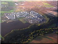
New housing estate at East Calder
On the edge of Almondell and Calderwood Country Park, with the valley of the River Almond in the lower half of the picture. For a ground view see Image
Image: © M J Richardson
Taken: 30 Sep 2017
0.08 miles
4
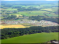
New housing estate at East Calder
On the edge of Almondell and Calderwood Country Park, with the valley of the River Almond in the lower half of the picture. For a ground view see Image
Image: © M J Richardson
Taken: 11 Jul 2018
0.12 miles
5

Gap in the Estate
The current map shows the houses on the left, but not those on the right. I am a little puzzled by this gap between their garden ground, for which there seems to be no reason. Perhaps time will tell.
Image: © Anne Burgess
Taken: 21 Feb 2018
0.14 miles

7
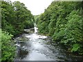
River Almond
Looking downstream from Naysmith Bridge. The river flows in a wooded gorge through Almondell and Calder Wood Country Park
Image: © Oliver Dixon
Taken: 17 Jun 2011
0.18 miles
8
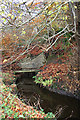
Canal Feeder
At this point the water in the channel feeding the Union Canal at Lin's Mill vaniches underground into a tunnel, one of several on its way from the weir above the Pipe Bridge to the canal basin.
Image: © Anne Burgess
Taken: 18 Nov 2016
0.18 miles
9

Rapids in the River Almond
The river is controlled in various places by weirs, but this looks like a natural rapid where the bedrock is resistant to erosion and forms a step in the river bed. As it was frosty and there was ice on the rocks, I decided not to venture down for a closer look to see what sort of rock it is, and the geological maps available online are not enlightening.
Image: © Anne Burgess
Taken: 18 Nov 2016
0.19 miles
10

Pillars of the Naysmith Bridge
The restored bridge over the River Almond in Almondell & Calderwood Country Park.
Image: © M J Richardson
Taken: 17 Mar 2010
0.19 miles