
IMAGES TAKEN NEAR TO
Binny Craig View, LIVINGSTON, EH53 0FT
Introduction
This page details the photographs taken nearby to Binny Craig View, EH53 0FT by members of the Geograph project.
The Geograph project started in 2005 with the aim of publishing, organising and preserving representative images for every square kilometre of Great Britain, Ireland and the Isle of Man.

There are currently over 7.5m images from over14,400 individuals and you can help contribute to the project by visiting https://www.geograph.org.uk
Image Map
Images are licensed for reuse under creativecommons.org/licenses/by-sa/2.0
Notes
- Clicking on the map will re-center to the selected point.
- The higher the marker number, the further away the image location is from the centre of the postcode.
Image Listing (6 Images Found)
Images are licensed for reuse under creativecommons.org/licenses/by-sa/2.0
Image
Details
Distance
1

Wasteland?: between Pumpherston and Roman Camp
A pond on the edge of one of the shale bings between Roman Camp and Livingston. Although not marked on any OS maps, the pond is clearly visible on satellite imagery. There are plans to develop housing here but the wildlife value of the area should not be under-estimated.
Image: © Margaret Pennington
Taken: 25 Jul 2006
0.10 miles
2
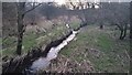
Pond Outflow joining Caw Burn
This muddy burn looks man-made to me, though it has followed the same course for at least 200 years, judging by old maps. The 1850s OS naming book says that it was "formed by the drainage of several fields," which kind of validates my theory that it is, in effect, a large drainage ditch, in its early stages at least. It eventually reaches the Brox Burn, which drains into the River Almond. It used to start somewhere in what is now Livingston, though it is hard to say exactly where, as it used to form some kind of administrative boundary, which always makes the old maps harder to decode. Today, though, it flows underground from an indeterminate point and only appears overground about a hundred yards from here. There is a Cawburn Inn in Pumpherston (which seems to have changed from a normal pub to a major darts and pool venue at some point in the twenty years or so since I was last there) just West of here - an indication of the burn's original course
The water joining it on the left comes from a smallish pond that must be the result of some remedial works to part of the vast former mining land around here, as it is not shown on any of the older maps available online (which stop in the late 1960s at present). The pond is shown on modern mapping, but the water leading from it to this spot is not.
Image: © Ian Dodds
Taken: 13 Mar 2022
0.17 miles
3

Common Blue (Polyommatus icarus), Roman Camp
The butterfly can be seen with Eyebright (Euphrasia officinalis agg.) and Yellow Meadow Vetchling (Lathyrus pratensis).
Image: © Mike Pennington
Taken: 25 Jul 2006
0.20 miles
4
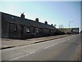
Miners' Row Pumpherston
Cottages on Drumshoreland Road.
Image: © Jim Smillie
Taken: 2 Apr 2009
0.22 miles
5

Industrial building at Pumpherston
Functional, utilitarian-looking building on the site of old shale bings - the remains of the world's first oil industry.
Image: © M J Richardson
Taken: 26 Nov 2009
0.23 miles
6
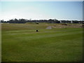
Pumpherston Golf Course
View over 16th tee.
Image: © Jim Smillie
Taken: 2 Apr 2009
0.23 miles