
IMAGES TAKEN NEAR TO
Wallace Mill Gardens, LIVINGSTON, EH53 0BE
Introduction
This page details the photographs taken nearby to Wallace Mill Gardens, EH53 0BE by members of the Geograph project.
The Geograph project started in 2005 with the aim of publishing, organising and preserving representative images for every square kilometre of Great Britain, Ireland and the Isle of Man.

There are currently over 7.5m images from over14,400 individuals and you can help contribute to the project by visiting https://www.geograph.org.uk
Image Map
Images are licensed for reuse under creativecommons.org/licenses/by-sa/2.0
Notes
- Clicking on the map will re-center to the selected point.
- The higher the marker number, the further away the image location is from the centre of the postcode.
Image Listing (54 Images Found)
Images are licensed for reuse under creativecommons.org/licenses/by-sa/2.0
Image
Details
Distance
1
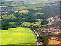
The Almond Valley at Mid Calder
Looking southeast from over Pumpherston. The edge of Livingston [Craigshill] is at lower right, with Mid Calder village above. East Calder is at upper left. The wooded area at upper right is Calder Woods, between the Linhouse and Murieston Waters, both flowing from the Pentland Hills.
Image: © M J Richardson
Taken: 11 Jul 2018
0.08 miles
2

Mid Calder from the air
The circular wood at Cunnigar is prominent.
Image: © Thomas Nugent
Taken: 13 Aug 2019
0.08 miles
3
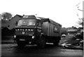
RHM lorry leaving the feed mill at Mid Calder -1978
The mill was at the end of Almondside, a short cul-de-sac. RHM was originally Rank-Hovis-McDougall. The mill has now gone, and the road is extended and filled with houses. The photo was one of a series taken to obtain a cub scout's 'photographer' badge, on the theme of transport.
Image: © Andrew Richardson
Taken: 25 Feb 1978
0.08 miles
4

Mid Calder from the air
The circular wood at Cunnigar is prominent.
Image: © Thomas Nugent
Taken: 13 Aug 2019
0.08 miles
5

The B8046 (Pumpherston Road) crossing the River Almond
Image: © Tim Heaton
Taken: 3 Jul 2018
0.11 miles
6
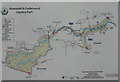
Almondell & Calderwood Country Park
Map at the Mid Calder entrance to the park.
Image: © M J Richardson
Taken: 9 Mar 2017
0.12 miles

8
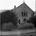
United Presbyterian Church, Midcalder
As seen in Winter 1973/4 when it was disused and semi-derelict. In May 1854 it replaced the original 1765 church on the site, which was becoming unsafe. It was subsequently demolished and the stone used to build a new house that incorporated a cottage on Pumpherston Road, which had been a post-medieval Toll House.
Image: © M J Richardson
Taken: Unknown
0.13 miles
9
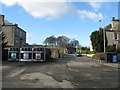
Recycling centre at Mid Calder
At the car park on Pumpherston Road [B8046], giving access to Almondell & Calderwood Country Park. Looking across the road to an entry between two houses leading to Cunnigar Hill.
Image: © M J Richardson
Taken: 9 Mar 2017
0.14 miles
10
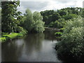
River Almond
Looking downstream from the road bridge at Mid Calder, with Willows and Sycamore. The ripples beyond the clumps of grass on the right mark the confluence with the Linhouse Water. For views at other seasons see Image and Image
Image: © M J Richardson
Taken: 9 Aug 2017
0.14 miles