
IMAGES TAKEN NEAR TO
Market Street, LIVINGSTON, EH53 0AA
Introduction
This page details the photographs taken nearby to Market Street, EH53 0AA by members of the Geograph project.
The Geograph project started in 2005 with the aim of publishing, organising and preserving representative images for every square kilometre of Great Britain, Ireland and the Isle of Man.

There are currently over 7.5m images from over14,400 individuals and you can help contribute to the project by visiting https://www.geograph.org.uk
Image Map
Images are licensed for reuse under creativecommons.org/licenses/by-sa/2.0
Notes
- Clicking on the map will re-center to the selected point.
- The higher the marker number, the further away the image location is from the centre of the postcode.
Image Listing (51 Images Found)
Images are licensed for reuse under creativecommons.org/licenses/by-sa/2.0
Image
Details
Distance
1

A very old watering hole
The Black Bull Inn, Mid Calder
Image: © James Denham
Taken: 12 Apr 2008
0.01 miles
2

Mid Calder
The centre of Mid Calder and the Black Bull.
Image: © Richard Webb
Taken: 10 Feb 2009
0.02 miles
3

Black Bull Inn
The inn stands on the north side of Market Street, which is wide and spacious here to accommodate a market.
Image: © Anne Burgess
Taken: 14 Apr 2016
0.02 miles
4

Black Bull Sign
This board adorns the wall of the Black Bull in Mid Calder.
Image: © Anne Burgess
Taken: 18 Nov 2016
0.03 miles
5

11 - 17 Bank Street
No 17, nearest to the camera, is 'in the style of the British Linen Bank', with distinctive architectural features. Next is No 15, a former Clydesdale bank, with a small Venetian window. Not sure what happened to No 13, but No 11 was the Oak Café.
Image: © Anne Burgess
Taken: 14 Apr 2016
0.03 miles
6

Main Street, Mid Calder
The former A71 on the west side of the centre of Mid Calder.
Image: © Richard Webb
Taken: 10 Nov 2011
0.05 miles
7

Bank Street Mid Calder
The Torphichen Arms which dates from around 1763 with Lodge St John 272 to the left.
Image: © Jim Smillie
Taken: 9 Jul 2009
0.07 miles
8
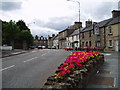
Mid Calder
This village is one of the most attractive villages in west Lothian despite being very close to the new town of Livingston. It was very much shaped by the droving of Cattle from the markets at Falkirk and Creiff south over the Pentlands to West Linton. The drove roads would converge here. The town was also on the Turnpike road between Edinburgh and Glasgow.
Image: © Kevin Rae
Taken: 11 Aug 2005
0.08 miles
9

Bank Street
18th century houses on the north side of Bank Street. I couldn't make up my mind whether the extension closest to the camera is original or a modern addition!
Image: © Anne Burgess
Taken: 14 Apr 2016
0.09 miles
10

Greenbank
This modern bungalow is beside the path above the left bank of the Murieston Water. It doesn't have too good a view because of all the trees, but it's a great place if you like birds. My uncle and aunt used to live here and it was always alive with songbirds.
Image: © Anne Burgess
Taken: 14 Apr 2016
0.10 miles