
IMAGES TAKEN NEAR TO
Pilton Gardens, EDINBURGH, EH5 2HY
Introduction
This page details the photographs taken nearby to Pilton Gardens, EH5 2HY by members of the Geograph project.
The Geograph project started in 2005 with the aim of publishing, organising and preserving representative images for every square kilometre of Great Britain, Ireland and the Isle of Man.

There are currently over 7.5m images from over14,400 individuals and you can help contribute to the project by visiting https://www.geograph.org.uk
Image Map
Images are licensed for reuse under creativecommons.org/licenses/by-sa/2.0
Notes
- Clicking on the map will re-center to the selected point.
- The higher the marker number, the further away the image location is from the centre of the postcode.
Image Listing (20 Images Found)
Images are licensed for reuse under creativecommons.org/licenses/by-sa/2.0
Image
Details
Distance
1

Pilton
Pre war housing scheme just inland from Granton.
Image: © Richard Webb
Taken: 7 Jun 2005
0.02 miles
2

Granton Parish Church
The original Parish Church was near the harbour. The present church was built when the Granton Housing Estate was built.
Image: © Sandy Gemmill
Taken: 11 Apr 2006
0.06 miles
3

Turf Zone "HolyGranton"
Granton Parish Church on Boswell Parkway, Edinburgh.
Image: © Ian S
Taken: 7 Dec 2022
0.14 miles
4

Boswell Parkway, Pilton
Site of the Embassy Cinema.
Image: © Richard Webb
Taken: 10 Jan 2016
0.15 miles
5

Granton Parish Church, Edinburgh
On Boswall Parkway between Wardieburn Street and Wardieburn Place.
Image: © G Laird
Taken: 2 May 2017
0.15 miles
6

East Pilton Farm Wynd
Modern high density housing on the site of a factory.
Image: © Richard Webb
Taken: 10 Jan 2016
0.18 miles
7
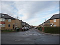
Pilton Place
Off Pilton Avenue.
Image: © Christine Johnstone
Taken: 18 Jan 2011
0.20 miles
8
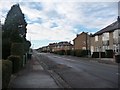
Pilton Avenue
All the street names on this estate begin with Pilton or Crewe.
Image: © Christine Johnstone
Taken: 18 Jan 2011
0.21 miles
9

Edinburgh Townscape : Presbytery of St. Margaret Mary, 87 Boswall Parkway, Pilton
Architect : Reginald Fairlie, 1939. Category C listed building.
Historic Environment Scotland (listed building description) describes the building thus:
"Summary
Category C
Group Category
Details 100000020 - See notes
Date Added 16/09/1998
Local Authority Edinburgh
Planning Authority Edinburgh
Burgh Edinburgh
NGR NT 23165 76540 Coordinates 323165, 676540
Description
Reginald Fairlie, 1939 with slightly later addition. Single storey, 9-bay, U-plan presbytery. Cape Dutch design. Brick base course, rendered and painted white above sill level. Brick sills to all windows.
S (ENTRANCE) ELEVATION: symmetrical arrangement; circular-plan step up to central entrance with gabled porch; semicircular-headed recessed door with brick architrave, stepped back in 3 stages. 3 regularly fenestrated flanking bays terminating in projecting pavilion bays, each with 3-light window.
E AND W ELEVATIONS: pavilion bays at either end of entrance elevation extend N to form wings. That to E has central gabled entrance porch with doorway flanked by narrow windows; single bay to either side; that to N has small flat-roofed extension. W wing longer and terminates in projecting pavilion type bay (most of this wing is slightly later addition).
COURTYARD ELEVATIONS: present U-shaped plan forms courtyard area to N. Rear of main body of building has 4 wide semicircular-headed windows; 2 similar to W side, to N of pilaster marking end of original building. Mainly 12-pane timber sash and case windows. Piended grey slate roof. Coped ridge stacks painted black and white: 3 to main body, 2 to E wing and 1 to N wing; round cans.
Statement of Special Interest
B group with adjacent St Margaret Mary's Church, also by Reginald Fairlie; designed as a part of the church complex here.
References
Bibliography PLAN submitted March 1939, in Dean of Guild, Building Control Section, Edinburgh; Patrick Nuttgens, REGINALD FAIRLIE (1959); John Gifford, Colin McWilliam and David Walker EDINBURGH in 'The Buildings of Scotland' series (first published 1984, this edition 1991) p601."
Source : Historic Environment Scotland online listing description (copied 11th July 2023).
Image: © Richard West
Taken: 15 Jan 2015
0.22 miles
10

The Strada, off Pilton Drive
East Pilton has become North Fettes.
Image: © Christine Johnstone
Taken: 18 Jan 2011
0.22 miles