
IMAGES TAKEN NEAR TO
Pilton Avenue, EDINBURGH, EH5 2HW
Introduction
This page details the photographs taken nearby to Pilton Avenue, EH5 2HW by members of the Geograph project.
The Geograph project started in 2005 with the aim of publishing, organising and preserving representative images for every square kilometre of Great Britain, Ireland and the Isle of Man.

There are currently over 7.5m images from over14,400 individuals and you can help contribute to the project by visiting https://www.geograph.org.uk
Image Map
Images are licensed for reuse under creativecommons.org/licenses/by-sa/2.0
Notes
- Clicking on the map will re-center to the selected point.
- The higher the marker number, the further away the image location is from the centre of the postcode.
Image Listing (36 Images Found)
Images are licensed for reuse under creativecommons.org/licenses/by-sa/2.0
Image
Details
Distance
1

The Strada, off Pilton Drive
East Pilton has become North Fettes.
Image: © Christine Johnstone
Taken: 18 Jan 2011
0.07 miles
2

East Pilton Farm Drive
Very new canyon like residential streets on a former industrial site.
Image: © Richard Webb
Taken: 10 Jan 2016
0.07 miles
3
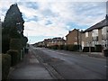
Pilton Avenue
All the street names on this estate begin with Pilton or Crewe.
Image: © Christine Johnstone
Taken: 18 Jan 2011
0.08 miles
4

Pilton Drive
Looking northwards to Pilton and Granton.
Image: © Christine Johnstone
Taken: 18 Jan 2011
0.08 miles
5
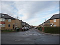
Pilton Place
Off Pilton Avenue.
Image: © Christine Johnstone
Taken: 18 Jan 2011
0.09 miles
6

Path to Ainslie Park Leisure Centre
From Pilton Drive.
Image: © Christine Johnstone
Taken: 18 Jan 2011
0.10 miles
7

Pilton Drive bridge
Crossing the former railway from Leith, now a cycleway and footpath.
Image: © Christine Johnstone
Taken: 5 Feb 2014
0.14 miles
8

Bridge for Pilton Drive, Edinburgh
On the cyclepath from Roseburn to Leith.
Image: © Jim Barton
Taken: 23 Jun 2016
0.14 miles
9
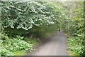
Trackbed, Leith North Branch
Part of what was once an extensive network of railways in North Edinburgh, made even more complex by the struggle between the Caledonian and North British Railways. This was a Caledonian line. Many of the old lines are now cycle paths.
Image: © Richard Webb
Taken: 4 Oct 2019
0.14 miles
10

Cycleway and footpath, west of Pilton Drive
The former railway line from Leith, opened in 1864.
Image: © Christine Johnstone
Taken: 5 Feb 2014
0.14 miles