
IMAGES TAKEN NEAR TO
Wyndford Place, BROXBURN, EH52 6TA
Introduction
This page details the photographs taken nearby to Wyndford Place, EH52 6TA by members of the Geograph project.
The Geograph project started in 2005 with the aim of publishing, organising and preserving representative images for every square kilometre of Great Britain, Ireland and the Isle of Man.

There are currently over 7.5m images from over14,400 individuals and you can help contribute to the project by visiting https://www.geograph.org.uk
Image Map
Images are licensed for reuse under creativecommons.org/licenses/by-sa/2.0
Notes
- Clicking on the map will re-center to the selected point.
- The higher the marker number, the further away the image location is from the centre of the postcode.
Image Listing (30 Images Found)
Images are licensed for reuse under creativecommons.org/licenses/by-sa/2.0
Image
Details
Distance
1

Uphall
New houses being built in Uphall. North of the Broxburn road, this is an area of rapid housing growth. View east with a sunlit Arthur's Seat in the distance.
Image: © Richard Webb
Taken: 21 Sep 2005
0.05 miles
2
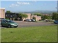
Wyndford Place
Terraced housing on the northern slopes of the Brox Burn at Uphall. Looking south east, towards the Pentland Hills.
Image: © M J Richardson
Taken: 14 May 2009
0.06 miles
3

Modern housing terrace in Uphall
Wyndford Place - one terrace of a group on the hillside above the A899 main road through Broxburn and Uphall.
Image: © M J Richardson
Taken: 14 May 2009
0.07 miles
4

Playing Field upgrade
Fence will be taken down when goalposts are erected in July after re-seeding is established
Image: © Jim Smillie
Taken: 1 Jun 2022
0.08 miles
5

Uphall Primary School and playing field
Image: © M J Richardson
Taken: 14 May 2009
0.13 miles
6

The mission at Uphall Primary School
To produce 'effective contributors', responsible citizens', 'successful learners', and confident individuals'
Image: © M J Richardson
Taken: 14 May 2009
0.15 miles
7

Uphall Cemetery
Laid out in Victorian style, the cemetery replaces the kirkyard at Strathbrock Parish Kirk, which would never have had the capacity to cope with the growing population.
Image: © Anne Burgess
Taken: 19 Feb 2013
0.16 miles


10

Uphall Cemetery
Laid out in Victorian style, the cemetery replaces the kirkyard at Strathbrock Parish Kirk, which would never have had the capacity to cope with the growing population.
Image: © Anne Burgess
Taken: 19 Feb 2013
0.19 miles