
IMAGES TAKEN NEAR TO
Tartraven Place, BROXBURN, EH52 5LT
Introduction
This page details the photographs taken nearby to Tartraven Place, EH52 5LT by members of the Geograph project.
The Geograph project started in 2005 with the aim of publishing, organising and preserving representative images for every square kilometre of Great Britain, Ireland and the Isle of Man.

There are currently over 7.5m images from over14,400 individuals and you can help contribute to the project by visiting https://www.geograph.org.uk
Image Map
Images are licensed for reuse under creativecommons.org/licenses/by-sa/2.0
Notes
- Clicking on the map will re-center to the selected point.
- The higher the marker number, the further away the image location is from the centre of the postcode.
Image Listing (22 Images Found)
Images are licensed for reuse under creativecommons.org/licenses/by-sa/2.0
Image
Details
Distance
1
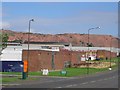
East Mains.
The square is nearly all industrial estate. Looking around it, it soon becomes obvious how much economic activity revolves around keeping the nations car fleet on the road.
Image: © Richard Webb
Taken: 30 Aug 2005
0.01 miles
2
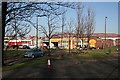
East Mains Industrial Estate
This is a vast industrial and business park on the eastern outskirts of Broxburn. In the background is the Greendykes Bing, a reminder of a bygone industrial age.
Image: © Anne Burgess
Taken: 19 Feb 2013
0.03 miles
3
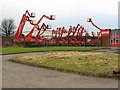
Reaching for the sky
Access equipment in waiting at the East Mains Industrial Estate.
Image: © M J Richardson
Taken: 21 Feb 2009
0.04 miles
4
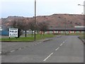
East Mains Industrial Estate
And, in the background, one of the few remaining oil-shale bings, the remains of the original Scottish oil industry, dating from the second half of the 19C.
Image: © M J Richardson
Taken: 21 Feb 2009
0.06 miles
5
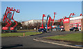
Cherrypickers
Loxam offers cherrypickers for hire. Business must be good, because there are rather fewer waiting for a job than in Image], taken almost exactly four years earlier.
Image: © Anne Burgess
Taken: 19 Feb 2013
0.06 miles
6
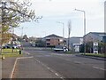
Dunnet Way
West Mains Industrial Estate.
Image: © Richard Webb
Taken: 22 Apr 2021
0.07 miles
7
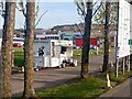
The Bapmobile
Catering trailer, West Mains Industrial Estate
Image: © Richard Webb
Taken: 22 Apr 2021
0.08 miles
8
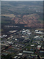
Greendykes Bing from the air
With East Mains industrial estate in the foreground.
Image: © Thomas Nugent
Taken: 3 Mar 2013
0.13 miles
9

Burnside at Broxburn
Farmland at Kilpunt and the East Mains Industrial Estate, with the Greendykes Bing in the distance.
Image: © M J Richardson
Taken: 7 Apr 2016
0.14 miles
10
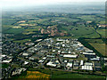
Broxburn from the air
With East Mains industrial estate in the foreground and Greendykes Bing and the River Forth in the background. The circular enclosure at West Farm http://canmore.rcahms.gov.uk/en/site/74469/details/west+farm/ can be seen to the left of the main Glasgow/Edinburgh railway line on the right side of the photo.
Image: © Thomas Nugent
Taken: 14 Jul 2013
0.14 miles