
IMAGES TAKEN NEAR TO
Stewartfield Road, BROXBURN, EH52 5EP
Introduction
This page details the photographs taken nearby to Stewartfield Road, EH52 5EP by members of the Geograph project.
The Geograph project started in 2005 with the aim of publishing, organising and preserving representative images for every square kilometre of Great Britain, Ireland and the Isle of Man.

There are currently over 7.5m images from over14,400 individuals and you can help contribute to the project by visiting https://www.geograph.org.uk
Image Map
Images are licensed for reuse under creativecommons.org/licenses/by-sa/2.0
Notes
- Clicking on the map will re-center to the selected point.
- The higher the marker number, the further away the image location is from the centre of the postcode.
Image Listing (60 Images Found)
Images are licensed for reuse under creativecommons.org/licenses/by-sa/2.0
Image
Details
Distance
1

Playing fields in Broxburn.
This view is looking south over the Eastern edge of Broxburn, towards the Pentland hills in the distance. This playing field and the all the woodland surrounding it was, not so long ago, a shale bing. Just shows what can be done!
Image: © Stan Grove
Taken: 2 Nov 2006
0.03 miles
2

"Pan Drop" factory
Recently saved from closure this is the home of "Pan Drops" a well known Scottish confection. The factory is actually in Broxburn about 8 miles from Edinburgh.
Image: © paul birrell
Taken: 4 Jun 2005
0.03 miles
3

Albyn Park, Broxburn
Beyond the fence is the rather smart home of Broxburn Athletic, who currently play in the East of Scotland League.
Image: © Richard Webb
Taken: 24 Mar 2018
0.14 miles
4

Greendykes Bing from the air
With the east end of Broxburn in the foreground and Winchburgh in the distance.
Image: © Thomas Nugent
Taken: 3 Mar 2013
0.14 miles
5
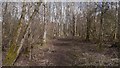
Woodland beside the Union Canal
On the site of the Stewartfield oil shale mine.
Image: © Richard Webb
Taken: 24 Mar 2018
0.16 miles
6

Greendykes Road
Until the 1950s or so, Greendykes Road ran between north-south orientated streets of cottages built for workers in the shale oil industry. These 'rows' have now been swept away and replaced with modern council housing, in blocks orientated east-west.
Image: © Anne Burgess
Taken: 17 Feb 2013
0.17 miles
7

Stewartfield football park, Broxburn
Autumn scene of playing fields next to Stewartfield in Broxburn, taken from the eastern side looking northwest.
Image: © Stan Grove
Taken: 2 Nov 2006
0.17 miles
8

Albyn Park, Home of Broxburn Athletic FC
Scottish Cup Preliminary Round, Broxburn Athletic 3 Blackburn United 0, Estimated Attendance 200
Both teams are in the East of Scotland Premier League, which sits at Tier 6 in Scotland's football pyramid. While the scoreline flatters the home side a bit, they were the deserving winners. Broxburn are in the red and white, which will be obvious to the experienced football fan by the railings etc. Blackburn, fittingly, play in the black - had they been a bigger team they would no doubt have been sporting an unnecessary away kit to boost football shirt sales!
There seems to have been a pitch here since the 1880s, and Broxburn Athletic, in some shape or form, did play on this ground - originally known as Albion Park - on and off before making it their permanent home immediately after the Second World War. The grass pitch was swapped for AstroTurf around 12 years ago.
The steep grass banks are impressive, and were very comfortable in the sunshine, and one of the people I was with was adamant that this half-time pie was the best he had ever had in 40 years of attending football matches! As is the norm with these smaller grounds, the advertisement boards promoting local businesses are written in such small type that only the players will have registered them.
Image: © Ian Dodds
Taken: 27 Aug 2022
0.18 miles
9

Unlaunching the launch
When the Union Canal between Edinburgh and Falkirk was re-opened in 2001-2 as part of the Millennium Link canal route across Scotland, West Lothian Council arranged for the building of one of the very few slipways on it at which boats can be launched. This is at Stewartfield, north of Broxburn and opposite a moonscape of waste from former shale mining and oil extraction operations. Here a small canal trip boat is about to be removed from the canal for its winter maintenance. In the far background is Greendykes Road bridge, built as part of the canal's rejuvenation.
Image: © A-M-Jervis
Taken: 2 Dec 2005
0.18 miles
10

Towpath along the Union Canal near Broxburn
In the distance is Bridge No 28.
Image: © Mat Fascione
Taken: 1 Jun 2016
0.18 miles