
IMAGES TAKEN NEAR TO
Westhall Gardens, BROXBURN, EH52 5DL
Introduction
This page details the photographs taken nearby to Westhall Gardens, EH52 5DL by members of the Geograph project.
The Geograph project started in 2005 with the aim of publishing, organising and preserving representative images for every square kilometre of Great Britain, Ireland and the Isle of Man.

There are currently over 7.5m images from over14,400 individuals and you can help contribute to the project by visiting https://www.geograph.org.uk
Image Map
Images are licensed for reuse under creativecommons.org/licenses/by-sa/2.0
Notes
- Clicking on the map will re-center to the selected point.
- The higher the marker number, the further away the image location is from the centre of the postcode.
Image Listing (24 Images Found)
Images are licensed for reuse under creativecommons.org/licenses/by-sa/2.0
Image
Details
Distance
1

Woodland path, Uphall
A path from Uphall to Broxburn running above the Broxburn.
Image: © Richard Webb
Taken: 25 Mar 2009
0.03 miles
2
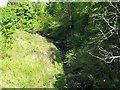
Light and shade on the Brox Burn at Uphall
Looking downstream, an almost reciprocal view to that of Richard Webb's Image
Image: © M J Richardson
Taken: 14 May 2009
0.05 miles
3

Footbridge, Uphall
The piers once carried a railway which served the oilshale mines to the north. Now there is a footbridge/cyclepath linking Uphall with its railway station using the surviving structure.
Image: © Richard Webb
Taken: 25 Mar 2009
0.06 miles
4
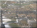
Aerial view of Uphall
Looking north over a still frozen landscape from above the M8 near Uphall Station, having just left Edinburgh Airport. The road heading north from the centre of the picture is the B8046 to Ecclesmachan and, offset left to the south, on the edge of the view, it is the road to Mid Calder. The two roads crossing from left to right are the A899 and A89 [both once-upon-a-time the A8].
Image: © M J Richardson
Taken: 3 Jan 2011
0.06 miles
5
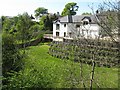
Gabions - buy four tiers, get one free?
Support for a new house on the north bank of the Brox Burn.
Image: © M J Richardson
Taken: 14 May 2009
0.09 miles

7

Uphall
East Main Street, Uphall after snow.
Image: © Richard Webb
Taken: 4 Mar 2009
0.10 miles
8

They are digging up Uphall again
I passed through here in 2005 chasing green squares. There were numerous roadworks then, and now in 2009 nothing has changed. Looking along West Main Street from outside a branch of Arnold Clark.
Image: © Richard Webb
Taken: 14 Jan 2009
0.10 miles

10

Uphall, seen from over Pumpherston
One of a string of ex-industrial/shale mining villages along the route of the old A8, now largely commuter belt. At tope left is Ecclesmachan and Oatridge College.
Image: © M J Richardson
Taken: 9 Feb 2015
0.11 miles