
IMAGES TAKEN NEAR TO
Joseph Cumming Gardens, BROXBURN, EH52 5AN
Introduction
This page details the photographs taken nearby to Joseph Cumming Gardens, EH52 5AN by members of the Geograph project.
The Geograph project started in 2005 with the aim of publishing, organising and preserving representative images for every square kilometre of Great Britain, Ireland and the Isle of Man.

There are currently over 7.5m images from over14,400 individuals and you can help contribute to the project by visiting https://www.geograph.org.uk
Image Map
Images are licensed for reuse under creativecommons.org/licenses/by-sa/2.0
Notes
- Clicking on the map will re-center to the selected point.
- The higher the marker number, the further away the image location is from the centre of the postcode.
Image Listing (13 Images Found)
Images are licensed for reuse under creativecommons.org/licenses/by-sa/2.0
Image
Details
Distance
1

A89 passing Broxburn
This used to be the A8 bypass of Broxburn and Uphall. Before the M8 was built this was a wider road (3 lanes) and the main route between Edinburgh and Glasgow.
Image: © Richard Webb
Taken: 6 Nov 2013
0.10 miles

4

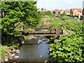
Path: Holmes Park
Brox Burn flows just to the right
Image: © Jim Smillie
Taken: 1 Jun 2022
0.16 miles
5

Cul-de-sac off Loaninghill Road
Modern housing like this has spread to occupy the ground south to the A89 Uphall and Broxburn bypass.
Image: © Anne Burgess
Taken: 19 Feb 2013
0.18 miles
6

Thule 279 information plaque
Thule 279 is a main belt asteroid, and part of the Kirkhill Pillar Project. For the sculpture see Image and Image
Image: © M J Richardson
Taken: 17 Mar 2010
0.20 miles
7

The asteroid Thule 279
Part of the Kirkhill Pillar Project, but too small to be represented here, so the seating, with engraved texts, acts as a substitute. For more information see Image
Image: © M J Richardson
Taken: 17 Mar 2010
0.20 miles
8

Part of Thule 279
One of three engraved sandstone seats representing the asteroid, which is in orbit between Mars and Jupiter. And also in the middle of a housing estate! See Image for the complete feature and Image for information about the sculpture.
Image: © M J Richardson
Taken: 17 Mar 2010
0.20 miles
9

An asteroid in Waterside Meadows
Part of the Kirkhill Pillar Project, these carved sandstone benches represent the main belt asteroid Thule 279. See Image for information.
Image: © M J Richardson
Taken: 17 Mar 2010
0.20 miles
10

Loaninghill Road
Newly built residential area, Uphall.
Image: © Richard Webb
Taken: 29 Jan 2009
0.20 miles