
IMAGES TAKEN NEAR TO
Hesperus Crossway, EDINBURGH, EH5 1GH
Introduction
This page details the photographs taken nearby to Hesperus Crossway, EH5 1GH by members of the Geograph project.
The Geograph project started in 2005 with the aim of publishing, organising and preserving representative images for every square kilometre of Great Britain, Ireland and the Isle of Man.

There are currently over 7.5m images from over14,400 individuals and you can help contribute to the project by visiting https://www.geograph.org.uk
Image Map
Images are licensed for reuse under creativecommons.org/licenses/by-sa/2.0
Notes
- Clicking on the map will re-center to the selected point.
- The higher the marker number, the further away the image location is from the centre of the postcode.
Image Listing (103 Images Found)
Images are licensed for reuse under creativecommons.org/licenses/by-sa/2.0
Image
Details
Distance
1
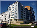
Coastal Edinburgh : The Wreck Of The Hesperus, Granton Harbour
Hesperus Crossway - where did this streetname come from?
Why Hesperus? Although being, in Greek mythology, the personification of the evening star (Venus), the name Hesperus usually brings to mind vague memories of an old painting of a shipwreck.
As for Crossway, the use of this term for a street is reminiscent of large-scale post-war local authority housing schemes where street-names often included terms like crossway, medway and parkway.
Image: © Richard West
Taken: 29 Sep 2012
0.02 miles
2

Heron Place from Hesperus Broadway
Looking south-east towards one of the new tenements which are part of the Leith and Granton redevelopment
Image: © M J Richardson
Taken: 8 Jan 2013
0.02 miles
3
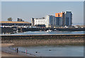
Granton Harbour
Like neighbouring Leith's, the harbour at Granton is being redeveloped, providing quayside flats right beside the marina. The small beach at Wardie, in the foreground, was proving popular with those oblivious of the March water temperature as the air temperature climbed to summer levels.
Image: © Anne Burgess
Taken: 27 Mar 2012
0.02 miles
4
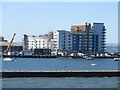
Apartment block, Granton Harbour, Edinburgh
A large, modern apartment block on the edge of Granton Harbour.
Image: © Graham Robson
Taken: 18 Apr 2015
0.03 miles
5

Granton Harbour
Flats have been built on ground reclaimed from the harbour.
Image: © Richard Webb
Taken: 20 Nov 2011
0.03 miles

7
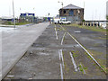
Railway tracks at Granton Harbour
A reminder that this was once an important commercial harbour. It was also served by the train ferries to Burntisland which operated from 1850 to 1890 when the Forth bridge was opened, making them redundant.
Image: © Alan Murray-Rust
Taken: 11 Jun 2013
0.05 miles
8

Slipway at Granton
Now run by the Royal Forth Yacht Club. It is approximately on the site of the original train ferry dock across the Forth to Burntisland.
Image: © Alan Murray-Rust
Taken: 11 Jun 2013
0.06 miles
9
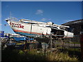
Coastal Edinburgh : Silver Dollar at Granton Harbour
I thought that silver dollars were supposed to be lucky.........
Image: © Richard West
Taken: 29 Sep 2012
0.06 miles
10

Granton Harbour
Looking across from North Granton Road to new housing blocks on Lonmay Road.
Image: © M J Richardson
Taken: 24 Sep 2011
0.06 miles