
IMAGES TAKEN NEAR TO
Boswall Loan, EDINBURGH, EH5 1AS
Introduction
This page details the photographs taken nearby to Boswall Loan, EH5 1AS by members of the Geograph project.
The Geograph project started in 2005 with the aim of publishing, organising and preserving representative images for every square kilometre of Great Britain, Ireland and the Isle of Man.

There are currently over 7.5m images from over14,400 individuals and you can help contribute to the project by visiting https://www.geograph.org.uk
Image Map
Images are licensed for reuse under creativecommons.org/licenses/by-sa/2.0
Notes
- Clicking on the map will re-center to the selected point.
- The higher the marker number, the further away the image location is from the centre of the postcode.
Image Listing (55 Images Found)
Images are licensed for reuse under creativecommons.org/licenses/by-sa/2.0
Image
Details
Distance
1

Granton Parish Church, Edinburgh
On Boswall Parkway between Wardieburn Street and Wardieburn Place.
Image: © G Laird
Taken: 2 May 2017
0.13 miles
2

Turf Zone "HolyGranton"
Granton Parish Church on Boswell Parkway, Edinburgh.
Image: © Ian S
Taken: 7 Dec 2022
0.15 miles


5

Turf Zone "BowlingPost"
At Boswell Drive Post Office, Edinburgh.
Image: © Ian S
Taken: 7 Dec 2022
0.16 miles

7

Wardieburn Place East
At its junction with Wardieburn Drive. An area of ex-council housing, now presumably mostly owner-occupied.
Image: © M J Richardson
Taken: 20 Aug 2008
0.17 miles
8

On Granton Road
Viewed in the corner of the square.
Image: © Mary and Angus Hogg
Taken: 17 Sep 2019
0.17 miles
9

Wardieburn Drive - northern end
More recent than the traditional Scottish tenements built of stone around the turn of the 19/20Cs, these were built in the 1930s.
Image: © M J Richardson
Taken: 20 Aug 2008
0.17 miles
10
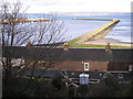
Granton Harbour from Granton Road
The view across the houses on Lower Granton Road to the Eastern Breakwater of Granton Harbour.
The houses in the foreground are on Lower Granton Road and the view here is of the rear of these properties. The back gardens have a steep incline and are difficult to maintain (but who needs an attractive back garden when you look out on the Forth and over to Fife).
Image: © Sandy Gemmill
Taken: 27 Jan 2007
0.17 miles