
IMAGES TAKEN NEAR TO
Lothian Street, BO'NESS, EH51 9BP
Introduction
This page details the photographs taken nearby to Lothian Street, EH51 9BP by members of the Geograph project.
The Geograph project started in 2005 with the aim of publishing, organising and preserving representative images for every square kilometre of Great Britain, Ireland and the Isle of Man.

There are currently over 7.5m images from over14,400 individuals and you can help contribute to the project by visiting https://www.geograph.org.uk
Image Map
Images are licensed for reuse under creativecommons.org/licenses/by-sa/2.0
Notes
- Clicking on the map will re-center to the selected point.
- The higher the marker number, the further away the image location is from the centre of the postcode.
Image Listing (13 Images Found)
Images are licensed for reuse under creativecommons.org/licenses/by-sa/2.0
Image
Details
Distance

2

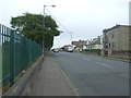
Dean Road (A993), Bo'ness
Looking north east.
Image: © JThomas
Taken: 21 Jun 2017
0.12 miles

5

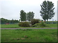
Kinglass Centre
One of the Medical practices was seeking new premises as was the Social Work Department. This brand new building with excellent facilities was the result.
Image: © Tom Sargent
Taken: 26 Aug 2007
0.18 miles
7

St Catharine?s church
This small church building is home to the Scottish Episcopal church congregation. Internally it is probably the most beautiful of Bo’ness churches. The church makes itself open to many organisations including the local branch of AA. St Catharine (note the spelling), legend has it, was a saint of Alexandria whose intellectual defence of Christianity so upset the pagan king that he had her crucified on a wheel. Pictures of her in European art often show her with the wheel.
Image: © Tom Sargent
Taken: 27 Oct 2004
0.21 miles
8

Chance park
This triangular park was the site of a Roman fort but the building at the far end has damaged part of it. Undermining by coal pits means that it is unlikely to be built on.
Image: © Tom Sargent
Taken: 12 Sep 2007
0.23 miles
9

Bo'ness from the shore
Writing in the 1720s, Defoe stated in his 'Tour Through the Whole Island of Great Britain', that Bo'ness "has been, and still is, a town of the greatest trade to Holland and France of any in Scotland, except Leith (...) for as they have the most shipping, so they are the best seamen in the Firth, and are very good pilots for the coast of Holland, the Baltic and the coast of Norway". From the 1770s, however, most of the burgh's trade was slowly lost to its rival, Grangemouth, following completion of the Forth-Clyde Canal.
"The houses, bearing the marks of antiquity, are low and crouded; but for the most part, clean and commodious. The smoke from the coal-works, was lately a great nuisance. The town involved continually in a cloud, the houses were blackened with soot, the air impregnated with vapour, and strangers were struck with the pandemonium appearance of the place. But these nuisances being now removed from the immediate vicinity, to a considerable distance, and more attention paid to cleaning the streets, the air is more pure and salubrious, and the town assumes a very different aspect. Still, indeed, the smoke from the Grange coal works on the east, the Bo-ness salt-pans on the west, and the dust excited by the carts carrying the coals to the quay for exportation, occasionally incommode the inhabitants."
-- Old Statistical Account, 1794
Image: © kim traynor
Taken: 12 Aug 2010
0.24 miles
10

Farm Shop
The end building was a workshop for the farm house (on right). When the farm was surrounded by housing the workshop was tidied up and simple provisions made available.
Image: © Tom Sargent
Taken: 26 Aug 2007
0.25 miles