
IMAGES TAKEN NEAR TO
Grangemouth Road, BO'NESS, EH51 0PU
Introduction
This page details the photographs taken nearby to Grangemouth Road, EH51 0PU by members of the Geograph project.
The Geograph project started in 2005 with the aim of publishing, organising and preserving representative images for every square kilometre of Great Britain, Ireland and the Isle of Man.

There are currently over 7.5m images from over14,400 individuals and you can help contribute to the project by visiting https://www.geograph.org.uk
Image Map
Images are licensed for reuse under creativecommons.org/licenses/by-sa/2.0
Notes
- Clicking on the map will re-center to the selected point.
- The higher the marker number, the further away the image location is from the centre of the postcode.
Image Listing (26 Images Found)
Images are licensed for reuse under creativecommons.org/licenses/by-sa/2.0
Image
Details
Distance
1

Cottages on the Grangemouth Road
Separated from the main part of the town, these cottages are far from quiet as the main road between Grangemouth and Bo’ness carries many workers to and from the refinery. Steam can often be seen rising from the woods behind as the railway climbs an incline along the hill in the woods behind.
Image: © Tom Sargent
Taken: 25 Aug 2007
0.01 miles
2

Old fingerpost
On the A904 Grangemouth Road through Kinneil is this fingerpost in desperate need of refurbishment. A small plaque near the base says GRANGEMOUTH/IRON WORKS. The lost finger said NETHER KINNEIL ½ MILE/UPPER KINNEIL ¾ MILE. Its HES Canmore ID is 366985.
Image: © John Riddell
Taken: 10 Oct 2021
0.02 miles
3

Old fingerpost
At the base of the fingerpost on Grangemouth Road in Kinneil can just be made out GRANGEMOUTH/IRON WORKS.
Image: © John Riddell
Taken: 10 Oct 2021
0.02 miles

5

Beside the Railway
Housing and factory units on either side of the A904 Grangemouth Road at East Kerse Mains seen from a passing train. Beyond is the Firth of Forth.
Image: © Martin Addison
Taken: 1 Aug 2018
0.05 miles
6
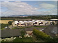
Furniture showroom
Alongside the A904 main road west of Bo'ness.
Image: © James Allan
Taken: 8 Jul 2017
0.08 miles
7

Small industrial Units
There is a ribbon of small factories on the road between Bo’ness and Grangemouth. As well as those shown here there is a bus garage and an electrical switchgear manufacturer.
Image: © Tom Sargent
Taken: 24 Aug 2007
0.09 miles
8

Overgrown pond
Dammed on the East side to provide a water reservoir for Kinneil House this pond is now very overgrown
Image: © Tom Sargent
Taken: 23 Feb 2003
0.09 miles
9

Cottages near East Kerse
On the Grangemouth road.
Image: © James Denham
Taken: 1 Mar 2009
0.11 miles
10
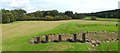
Kinneil Roman fortlet
The line of the Antonine Wall can be seen as a raised area receding directly from the photographer's position. Kinneil fortlet itself is attached to the southern (right) side of the Wall; see Image and Image for views of that area.
The stony area cutting through the line of the wall is the remains of a road that led through the fortlet, passing under a gate tower here (this was the northern gate of the fortlet). The posts mark the places where timbers associated with the gate tower were found. See Image for an earlier photograph of the road from another angle, in which the drains on either side of the road are more clearly evident.
In the middle distance, there is a shallow depression to the north (the left) of the line of the Wall. This, though slight, is a genuine remnant of the ditch of the Antonine Wall.
The present-day Dean Road (which passes through Image) and part of Grahamsdyke Road (passing through Image) in Bo'ness continue the line of the Wall; the latter road retains an old name for the Wall: Graham's Dyke (from the earlier Gryme's or Grim's Dyke).
According to David J. Breeze, in "The Antonine Wall" (2006), "John of Fordun, writing in the fourteenth century, stated that it was called 'Grymisdyke' because it had been destroyed by Gryme, grandfather of King Eugenius, himself a mythical figure", while the sixteenth-century scholar George Buchanan offered the explanation that Graeme was a leader of the Picts and Scots who had broken down the wall to allow his people to invade the Roman province. Breeze notes that this name for the wall may in fact be from a Celtic word [the Welsh "grym" (might, power, force, strength; hence, the "strong dyke"). "Grym" is evidently akin to the Gaelic word "greim" – see Alexander Macbain's "Etymological Dictionary of Scottish Gaelic"].
Image: © Lairich Rig
Taken: 3 Sep 2011
0.12 miles