
IMAGES TAKEN NEAR TO
Bo'Mains Road, BO'NESS, EH51 0LN
Introduction
This page details the photographs taken nearby to Bo'Mains Road, EH51 0LN by members of the Geograph project.
The Geograph project started in 2005 with the aim of publishing, organising and preserving representative images for every square kilometre of Great Britain, Ireland and the Isle of Man.

There are currently over 7.5m images from over14,400 individuals and you can help contribute to the project by visiting https://www.geograph.org.uk
Image Map
Images are licensed for reuse under creativecommons.org/licenses/by-sa/2.0
Notes
- Clicking on the map will re-center to the selected point.
- The higher the marker number, the further away the image location is from the centre of the postcode.
Image Listing (8 Images Found)
Images are licensed for reuse under creativecommons.org/licenses/by-sa/2.0
Image
Details
Distance

2

The Lairig public house, Dean Road, Bo'ness
Image: © JThomas
Taken: 21 Jun 2017
0.12 miles

4

Bus stop and shelter on Dean Road, Bo'ness
Looking north east.
Image: © JThomas
Taken: 21 Jun 2017
0.14 miles
5

Castlehill
Residential street, Castleloan
Image: © Richard Webb
Taken: 4 Sep 2009
0.15 miles
6
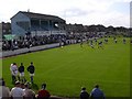
Newtown Park, Bo'ness. Football ground
Newtown Park. Home of Bo'ness United FC
Image: © paul c
Taken: 3 Sep 2004
0.21 miles
7
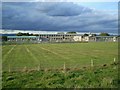
Kinneil School from the south
A large primary school
Image: © Tom Sargent
Taken: 23 Sep 2007
0.23 miles
8

Woodlands Care Home
This is home to 10 frail elderly people. Each has their own front door and en suite shower and toilet. There are snack making facilities but meals are prepared for all residents by the care staff.
Image: © Tom Sargent
Taken: 24 Aug 2007
0.25 miles