
IMAGES TAKEN NEAR TO
Deanfield Crescent, BO'NESS, EH51 0EU
Introduction
This page details the photographs taken nearby to Deanfield Crescent, EH51 0EU by members of the Geograph project.
The Geograph project started in 2005 with the aim of publishing, organising and preserving representative images for every square kilometre of Great Britain, Ireland and the Isle of Man.

There are currently over 7.5m images from over14,400 individuals and you can help contribute to the project by visiting https://www.geograph.org.uk
Image Map
Images are licensed for reuse under creativecommons.org/licenses/by-sa/2.0
Notes
- Clicking on the map will re-center to the selected point.
- The higher the marker number, the further away the image location is from the centre of the postcode.
Image Listing (32 Images Found)
Images are licensed for reuse under creativecommons.org/licenses/by-sa/2.0
Image
Details
Distance
1
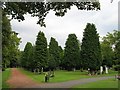
Cemetery, Bo'ness
Near the Deanfield Road entrance.
Image: © Richard Webb
Taken: 4 Sep 2009
0.06 miles
2

Calder park
Calder park at the rear of Deanfield road looking east towards the Old Kirk
Image: © Bob Simpson
Taken: 3 Jan 2011
0.07 miles
3

Bus stop and shelter on Dean Road, Bo'ness
Looking north east.
Image: © JThomas
Taken: 21 Jun 2017
0.14 miles
4
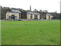
New houses on Corbiehall
At the foot of Pan Braes. This was a building site on Google Earth in May 2008.
Image: © M J Richardson
Taken: 14 Mar 2012
0.14 miles


9

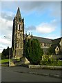
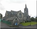
Bo'ness Old Kirk
A Gothic design by Robert Thornton Shiells and James M Thomson, this was originally Bo'ness Parish Kirk. It dates from 1885-1888.
Image: © Anne Burgess
Taken: 24 Mar 2014
0.15 miles
10

Pigeon Lofts
Pigeon lofts ( doocots ) located to the north side of Calder park in Deanfield area of the town.
Looking out over Kinneil foreshore, the river Forth onto Longannet power station.
Image: © Bob Simpson
Taken: 3 Jan 2011
0.15 miles